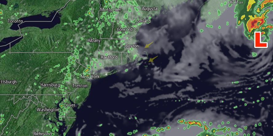
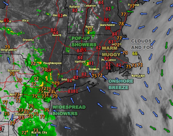
There was a lot going on weather-wise in the Northeast on Wednesday. Clouds and fog were stubborn near the coast, and the low cloud cover and onshore breeze had the temperature in the mid 60s on Cape Cod. In RI and interior SE MA, it was mostly sunny, warm, and humid. Highs reached the low to mid 80s away from the coast. Showers were popping up over interior Southern New England. The slow-moving areas of rain were producing about an inch per hour in parts of CT and MA. The shower threat will stay confined to interior Southern New England Wednesday evening. Low clouds and fog will return to most of RI and SE MA. Visibility may drop below 1/4 mile. Lows will be in the low 60s early Thursday morning.
Thursday looks like Wednesday, but a bit cooler. Clouds will hang around near the coast, and there should be partly sunny skies inland. Highs inland will be in the mid 70s. It will stay in the low 70s near the coast. Look for a 5-10 mph east-northeast breeze. Friday should be a typical late-August day, with partly sunny skies and highs in the upper 70s to low 80s.

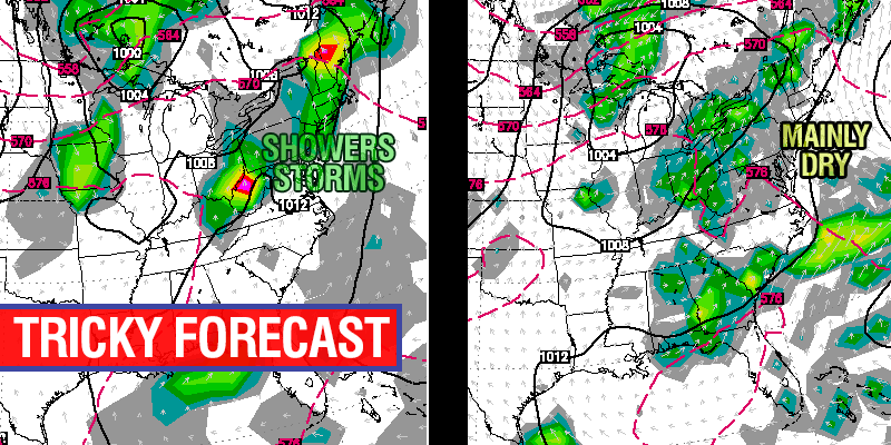
The forecast for the Labor Day weekend continues to be tricky. At this point, we expect Saturday to be partly sunny and humid. Highs will range from the mid 70s near the coast to mid 80s well inland. A slow-moving weather system west of New England may get close enough to bring showers on Sunday and Monday. It is also still possible that it stays far enough west that the weather stays mainly dry both of those days. Right now, it’s too close to call, and we really do not have a firm handle on whether it will rain Sunday and/or Monday. If you have outdoor plans, do not cancel them, but stay close to the forecast for the next couple of days. In a worst-case scenario, it’s showery and in the 70s, in a best-case scenario, the weather will be similar to what we’re expecting for Saturday.
The forecast for Monday night into Tuesday is actually easier to discern. Showers and thunderstorms are likely as a strong cold front moves through the Northeast. The showers may linger through Tuesday morning as the front moves offshore. Dry and pleasant weather is in the forecast for the middle of next week.


