There has not been a widespread blockbuster storm in Southern New England this winter, and Tuesday night into Wednesday is looking like another high-end moderate snowstorm for most of the area. Some may get 10″ of snow, but most spots should see lower totals. It will be a very cold storm, with temperatures dropping into the teens and single digits by late Tuesday night. Here is a look at some of the “real world” impacts from the storm.

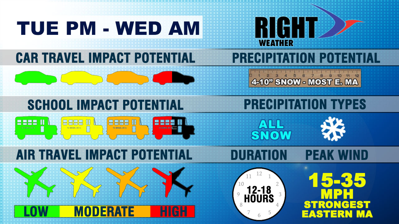
Car Travel Impact – The storm may not arrive soon enough to drastically slow the early evening commute, but it will be troublesome for anyone traveling after 6 pm Tuesday through around 8 am Wednesday. The snow will be falling into very cold air, and it should stick on contact on any untreated surfaces. While not a worst-case scenario, the travel Tuesday night will be treacherous in spots.
School Impact – If the storm arrives sooner and heavier than expected on Tuesday, this easily becomes a max impact storm for the schools. Hopefully, it’s not a “December Debacle” sequel. It looks like the kids will get home without many problems on Tuesday. Wednesday morning, however, there should be several inches of snow on the ground, and it will still be snowing between 6-8 am. Also, the temperature will be in the single digits to teens. Even though the snow should end by mid to late morning, it seems that a snow day is in order for Wednesday.
Air Travel Impact – While not the biggest or longest lasting storm ever, this storm will have an impact in all the big cities of the Mid-Atlantic and Northeast. The worst of the storm will be late-evening and early morning in Boston and Providence, but an earlier impact in NYC, DC, and Philadelphia could put the brakes on air travel in the Northeast.
Snow totals – 4-10″ is the current range for SNE. We expect the higher totals from the I-95 corridor to the coast. There should be a “fluff factor”, but that is hard to predict. The January 2-3 storm was very cold, but the snow in Bristol, RI was nearly 10:1 ratio – which is par for the course for Southern New England. If the fluff factor maxes out, then the totals will be near a foot in the hardest hit areas.
Precipitation type – All snow.
Duration – 12-18 hours of accumulating snow. Not the longest storm, but long enough to let the snow pile up. Most of the piling occurs at night.
Peak wind – 15-35 mph – strongest on Cape Cod and islands. We’ll be on the lookout for higher gusts, and a Blizzard Watch is in effect for part of Eastern MA.


