Monday was mostly cloudy and very humid in Southern New England. Scattered showers developed in the afternoon, and the threat of occasional showers and thunderstorms with heavy downpours continues through the midweek. There is a decent chance of rain Monday evening and night as a disturbance moves through. Because of the very humid air, any showers may contain torrential downpours. If showers become stationary over any area for an hour or more, then flash flooding is possible. Lows will be near 70 on Tuesday morning.

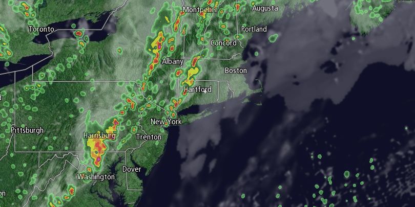
Tuesday looks partly to mostly cloudy, breezy, and humid. The shower/storm threat is greatest over inland Southern New England on Tuesday. It’s possible it will be a mainly dry day from the coast of RI to Cape Cod. Providence and Boston are right on the edge of the favored area for showers and storms. The best chance of seeing strong to severe thunderstorms is in CT and central/western MA. Highs will be in the upper 70s to low 80s as it stays very humid.
The line of showers and thunderstorms will slowly move east Tuesday night into Wednesday. That is when there is the best chance of rain in Rhode Island and Southeastern Massachusetts. Rain may be heavy at times, and localized flooding is possible. The National Weather Service has posted a Flash Flood Watch for most of Southern New England through Wednesday afternoon. The potential exists for some areas to receive more than three inches of rain.

Wednesday morning looks wet, with heavy downpours possible. It will gradually dry out Wednesday afternoon and evening, and better weather is ahead Thursday and Friday. Wednesday’s highs will be in the 70s with it turning less humid late. Skies will become partly to mainly clear Wednesday night. The temperature will fall into the low to mid 60s.
Thursday should be a decent day with partly sunny skies and highs in the upper 70s to low 80s. It will not be humid from Thursday into the weekend. Lows Thursday night will be in the upper 50s to low 60s under clear skies. Friday looks mostly sunny with highs near 80. There will be some clouds around on Saturday. It should stay dry, with highs in the upper 70s to low 80s. Showers are possible on Sunday, but it’s still an early outlook, and the weather system that could bring rain may stay south of Southern New England.


