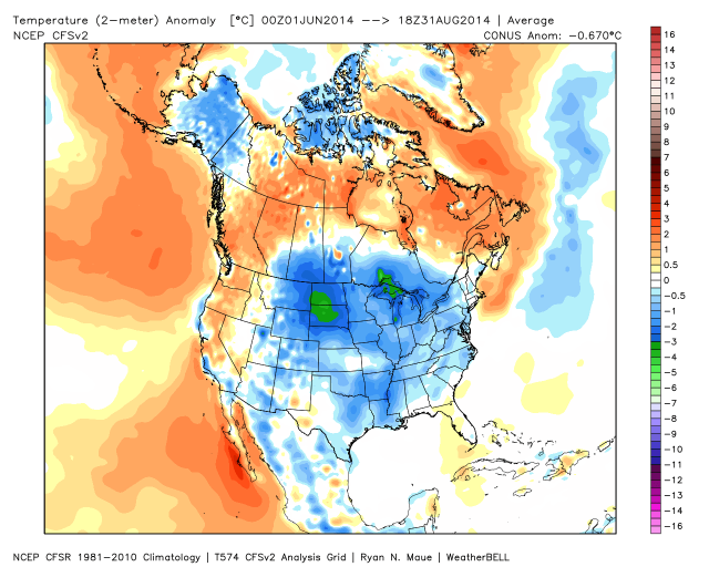
Meteorological summer is in the books. It was slightly cooler than normal in most of Southeastern New England. June and July were near normal, but August was about 2° cooler than normal, and enough to offset any warmth in the first two months. The season was notable because of the lack of extreme heat – something we foresaw in our summer outlook. As usual, rainfall totals varied widely based on the localized nature of summer storms. Coastal Southeastern Massachusetts saw more rain than normal, but most of RI had a dry summer – which we also predicted in our summer outlook. So far, the hurricane season is running well below normal, as expected.

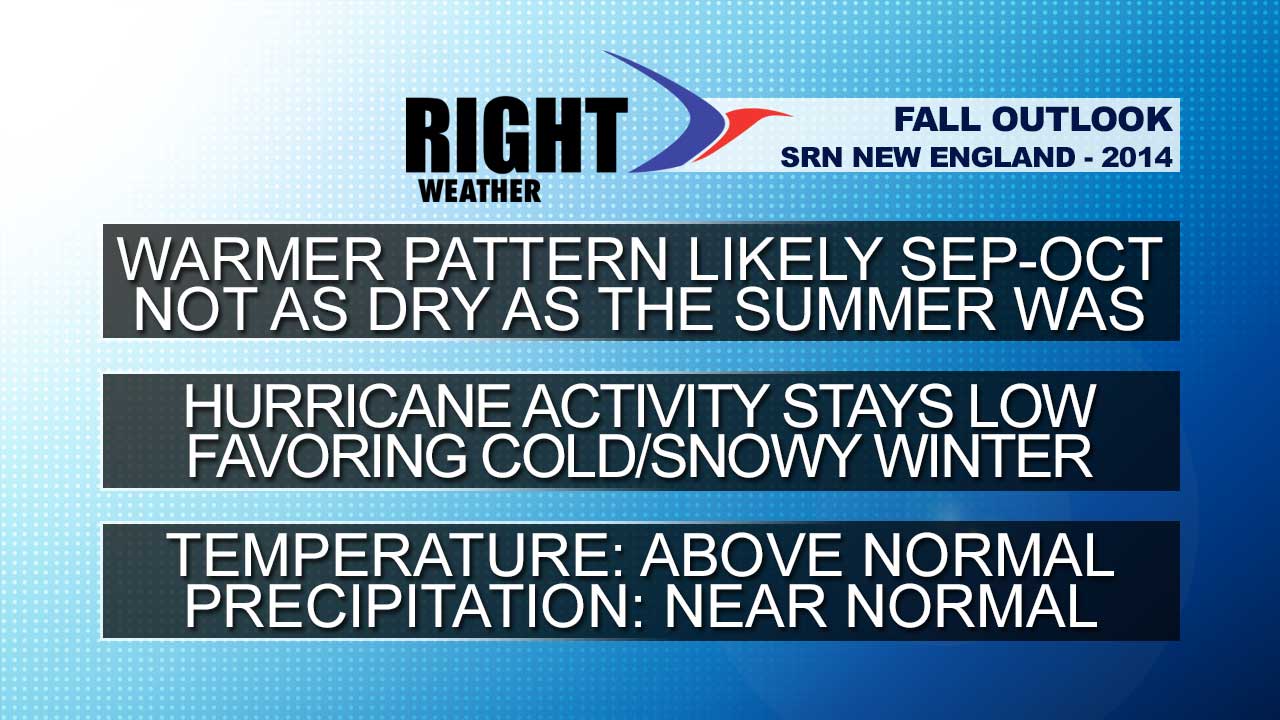
Fall Outlook
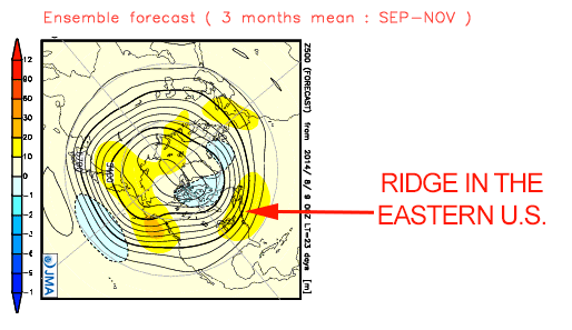
The warmer than normal weather that we’ll have in the first week of September is a sign of what we expect for at least the first half of the fall (Sep-Nov). It finally looks like a ridge is setting up along the Eastern Seaboard, and that should make September warmer than normal, and possibly the warmest month of the year – relative to normal. That’s not saying much since there has not been a month more than 0.6° warmer than normal this year in the Providence area.
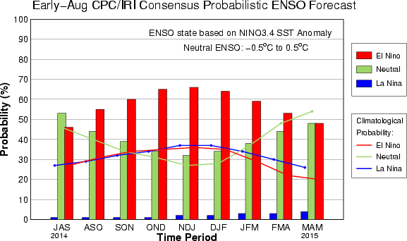
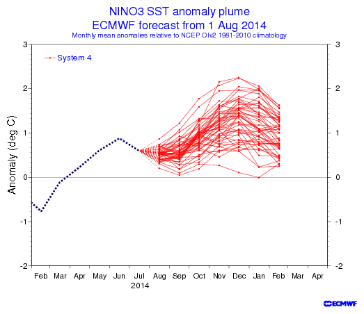

At one point, it looked like an El Niño was near certain for the fall and winter. The latest update from NOAA has lowered the odds of an El Niño to about 65% for the fall and winter. It does not look like there will be a strong El Niño developing. Even though there has not been much warming in the equatorial Pacific Ocean, it has been a quiet hurricane season. We do not expect there to be much change in that regard for the rest of the season. Typically, the action picks up in September, peaking early in the month, and we expect increased activity relative to what’s happened so far, but not enough to make it a near or above normal season. The Accumulated Cyclone Energy (ACE) is running ahead of last year’s anemic pace, and should not be as low by the end of the season. Last year the ACE in the Atlantic Basin was 30% of normal. This year, so far, it’s 58% of normal.
Here is the latest NOAA Seasonal Outlook:
7-12 Named Storms
3-6 Hurricanes
0-2 Major Hurricanes
Accumulated Cyclone Energy (ACE) range of 40%-90% of the median.
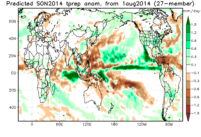
Precipitation forecasts are always tricky, and the potential for a developing El Nino lends itself to wet weather in the Northeast. However, barring a tropical system, we do not expect September to be a very rainy month. Overall, we expect there to be near normal precipitation in Southern New England this fall.
A Peek at Winter
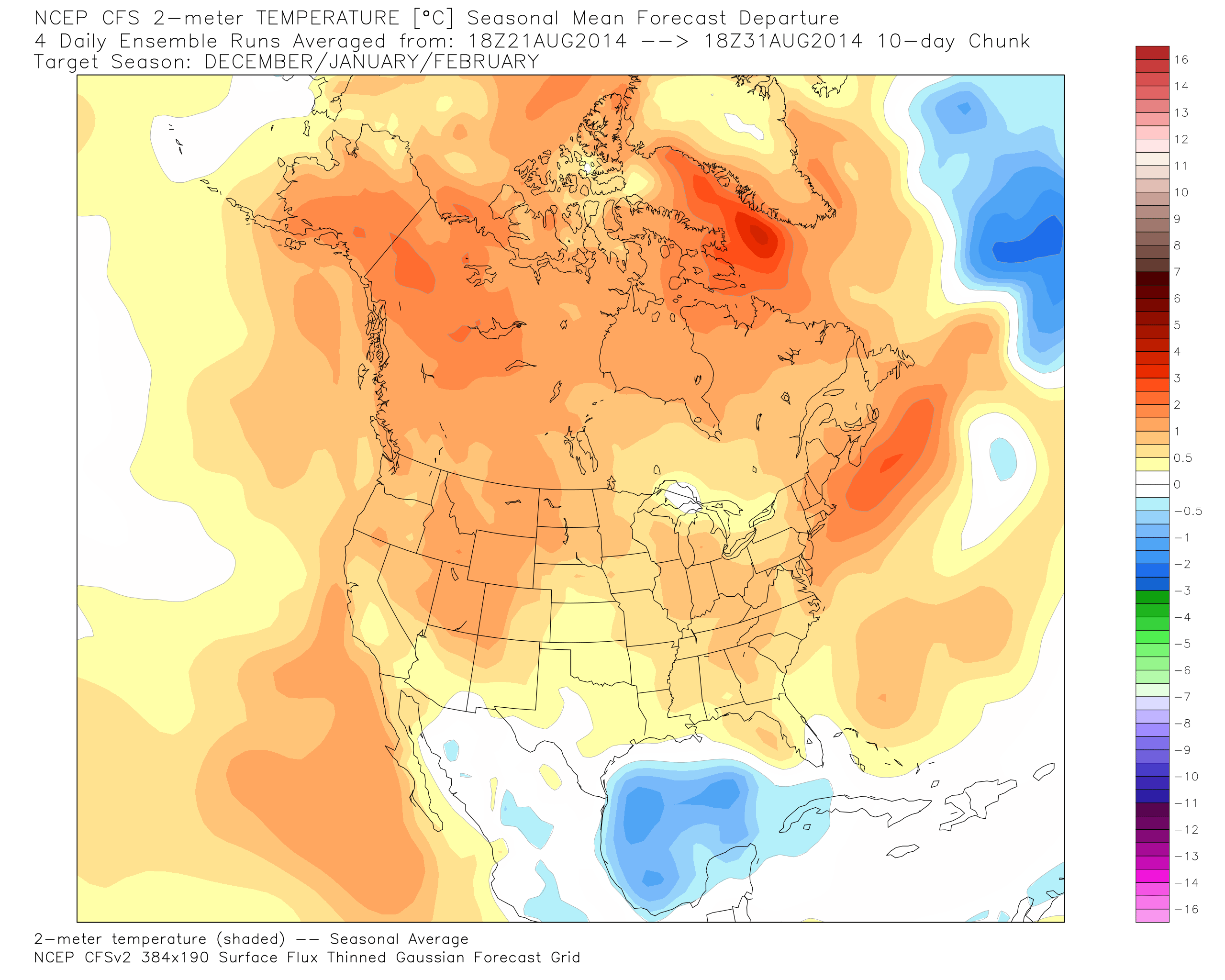
Looking ahead to winter, we are favoring an active winter in the Northeast. Our preliminary outlook is for near to below normal temperatures and above normal precipitation and snowfall. The JAMSTEC (Japanese) model is bullish on cold weather for the US this winter, the CFS (American) model paints a different picture, but has been trending colder. In my opinion, the JAMSTEC has a better track record than the CFS.