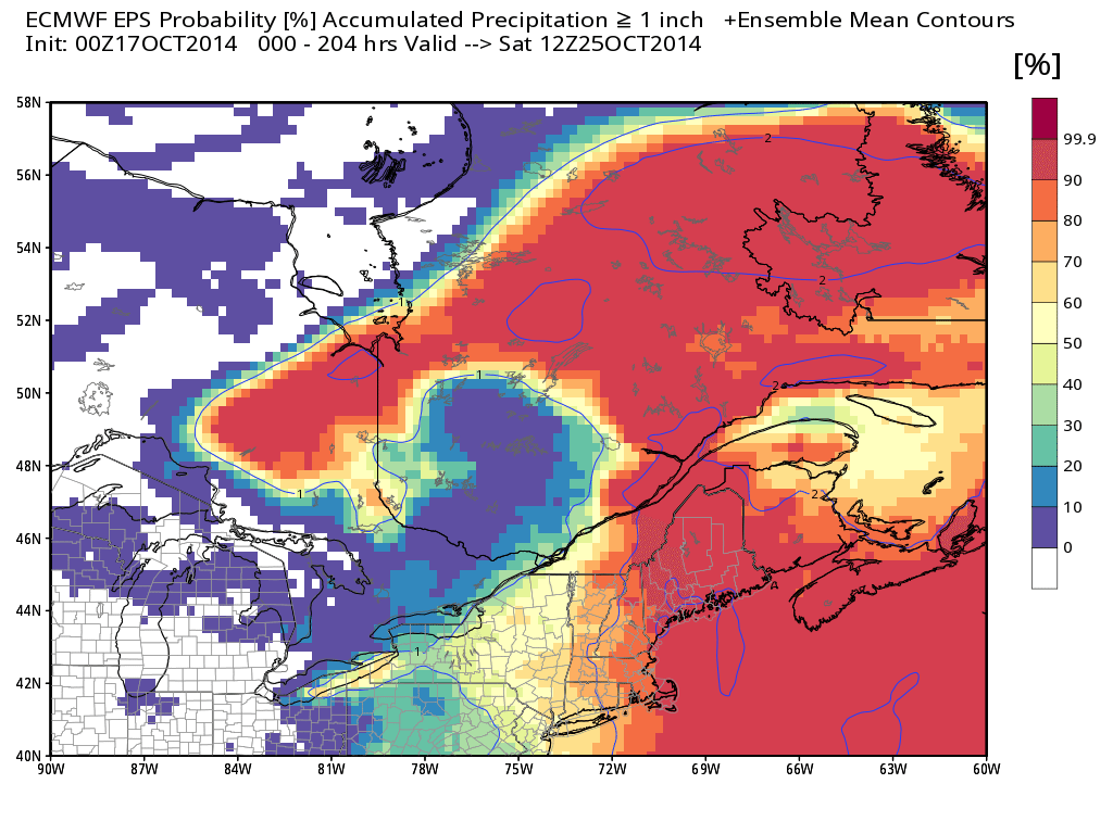
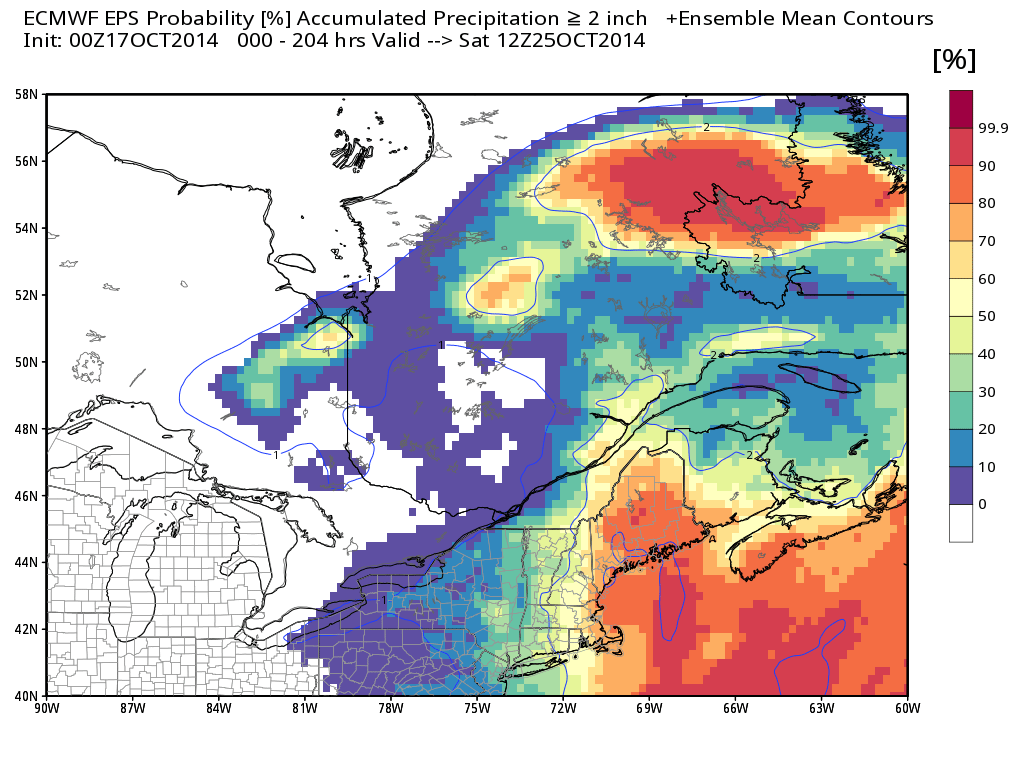
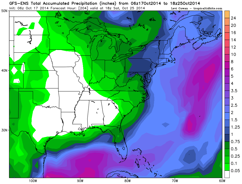
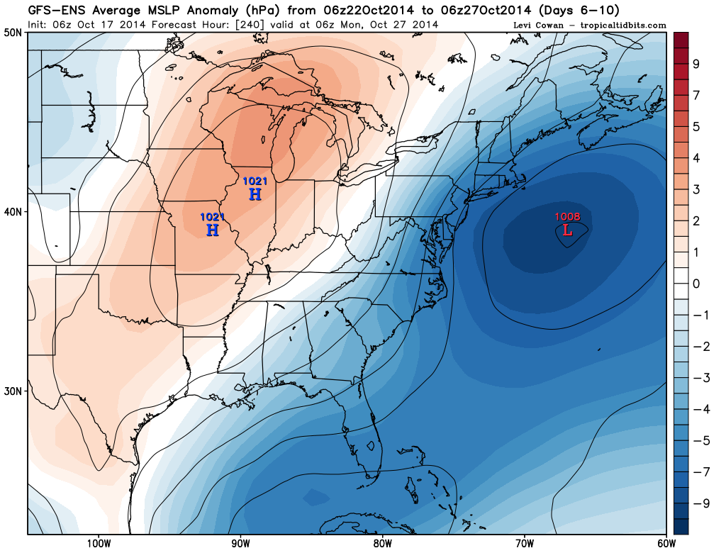
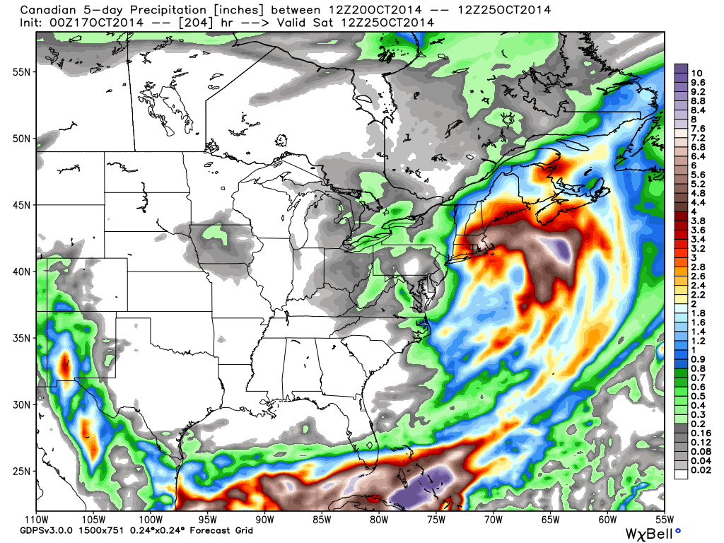
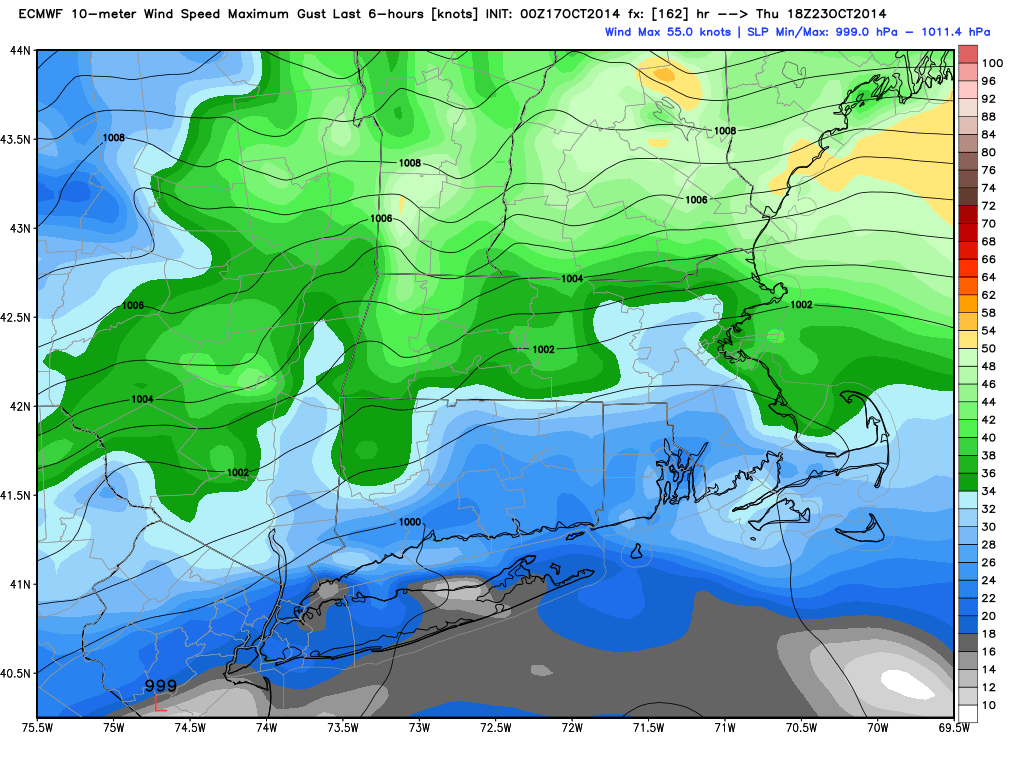
A significant long-duration storm appears likely for New England in the middle to end of next workweek. The storm will move from the Great Lakes to the Southern New England coast and intensify on Tuesday into Wednesday. The storm will become cut-off from the jet stream, and will likely not move much through the end of next workweek.
While the exact track of the storm is questionable, there is the potential for several inches of rain in the hardest hit areas. At this point, it seems that Eastern New England will bear the brunt of the storm with the heaviest rain, strongest winds, and possible coastal flooding due to a persistent northeast wind direction for several days.
Even though the event is still several days away, all reliable computer models are predicting that a storm will form off the New England coast and remain nearly stationary for at least a couple of days. See the graphics below for more explanation on the storm’s potential impacts.