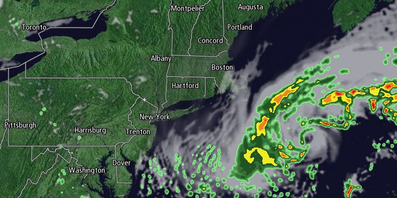
Beneficial rain fell in Southern New England on Wednesday. It was steadiest in Eastern Massachusetts where more than an inch fell by late in the day. Rhode Island saw less than an inch as of early Wednesday evening, but it was still a welcome sight after one of the driest Septembers on record.
Showers, drizzle, mist and fog are likely into early Thursday morning, with the steadiest rain continuing in Southeastern Massachusetts. Localized street flooding is possible near Buzzards Bay and on Cape Cod. Lows will be in the mid to upper 50s.

After a murky start, conditions will gradually improve from west to east on Thursday. Some afternoon sunshine is possible, with highs in the low to mid 60s. There will be a 10-20 mph northeast breeze. Friday night will be partly cloudy with patchy fog and lows in the mid to upper 40s.
There will be some sunshine on Friday, and the high temperature will be near 70. You can expect a light breeze and an overall pleasant day. The wind will swing around to the southeast ahead of a frontal system Friday night. It will become damp with lows near 50.
Saturday looks mostly cloudy with showers developing around midday and continuing through the afternoon. A thunderstorm cannot be ruled out. The whole day will not be a washout, but it could be soggy during the afternoon. Highs will be in the mid 60s. There will be a gusty southerly wind ahead of a cold front that will swing through Saturday evening.
Sunday looks partly sunny, brisk, and dry. Highs will be in the low 60s with a 10-20 mph westerly breeze that diminishes in the afternoon. It will likely stay dry on Monday before more showers threaten on Tuesday.


