Long-Range Forecast – October 16

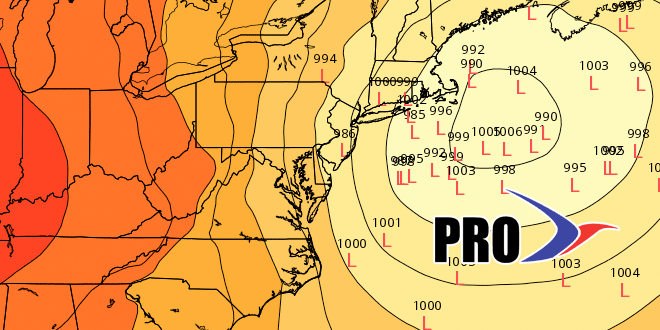
It looks like a slow-moving weather pattern will continue for the rest of October. Unfortunately, that could mean an extended period of wet and cool weather from the middle to end of next workweek. The models are coming together on a cut-off storm that sits and spins off the New England coast for a few days. If the storm is near Nantucket, then you can bank on wet, breezy, and raw weather in Southeastern New England. Right now, it looks like the main threat is from late Tuesday through Friday.
After the storm drifts out to sea, we should get into several days of dry weather. It does not look like any huge cold shots are in the forecast except for a quick chilly blast on Sunday into Monday that will keep the daytime temperature in the low to mid 50s, and it will fall into the 30s to low 40s at night. The breeze will stay active, so a frost may not occur near the coast and cities. The pattern for the last week of October is leaning toward warmer than normal weather. See the video for more details.


