A potentially crippling Nor’easter will pummel Southeastern New England from Monday afternoon into early Wednesday. The height of the storm is likely Monday night, but, since it’s a slow-mover, snow will continue through Tuesday and into early Wednesday morning. The storm will most likely shut down or severely limit travel from New York City through New England. Strong winds and heavy snow could lead to widespread power outages.
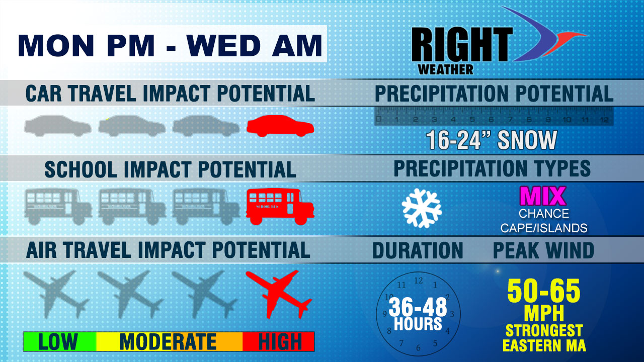
This is a serious and potentially life-threatening storm. It should not be taken lightly. The National Weather Service has issued a Blizzard Watch for most of Southeastern New England. Snow totals averaging 20″ are expected in Rhode Island and Southeastern Massachusetts.

Car Travel Impacts
Roads may be impassable Monday night into early Tuesday with heavy wind-driven snow expected. Significant blowing and drifting will make travel difficult into at least early Wednesday.
School Impacts
There is a chance that it could be a slow ride home from school on Monday as snow develops from south to north in the afternoon. It is extremely unlikely that there will be school on Tuesday. Schools may be closed Wednesday as the area recovers from the storm. Power outages are possible, and that could extend school cancellations.
Air Travel Impacts
This is the type of storm that will lead to widespread flight cancellations and most likely airport closures.


