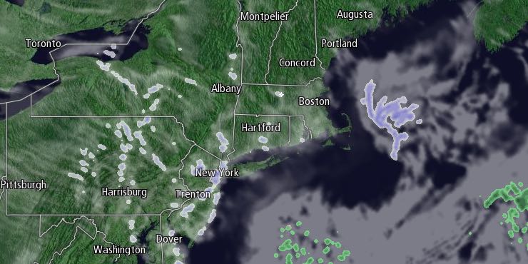
Southern New England received a glancing blow from a storm passing out to sea off the Mid-Atlantic coast on Thursday. A period of light snow around midday did not accumulate too well, and it ended by mid-afternoon. Thursday night will be partly to mostly cloudy and cold. Lows will range from the upper single digits inland to the mid teens near the coast.

It will be partly cloudy and cold on Friday. Highs will be in the mid to upper 20s with a light northwest breeze. Skies will clear Friday night, and the temperature will tumble to near zero by dawn on Saturday. The best chance of reaching zero or colder is in the countryside. It will likely be in the single digits in the cities and near the coast.
Saturday afternoon will be mostly sunny, but still cold for late February. Highs will be in the upper 20s to low 30s without much a breeze. It wll stay cold Saturday night. Lows will be in the single digits to teens early Sunday morning. Clouds will increase on Sunday ahead of the next storm system. Highs will be in the low 30s. Snow or mixed precipitation will develop Sunday evening. Right now, we’re favoring snow instead of a wintry mix. It will continue through the night, ending near dawn on Monday. Some snow accumulation is possible, but it does not look like a major event. Highs will be in the low 30s on Sunday, and it will be in the 20s to low 30s Sunday night.
Monday will become partly cloudy with highs in the mid 30s. Tuesday looks dry and cold before another storm system threatens with snow changing to a mix and then rain in the middle of next week.


