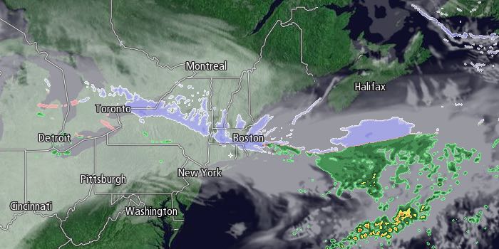
Occasional light snow fell in RI and SE MA on Saturday at the start of a long-duration snow event that will last through Monday. The National Weather Service has issued a Winter Storm Warning. The snow was light and spotty, and did not stick well during the day. Steadier snow will develop Saturday night, especially north of Providence. 2-3″ may accumulate in northern RI and northern Bristol County Massachusetts by early Sunday morning. 1-2″ is possible from the coast to Providence. Lows will be in the 20s.

Occasional snow will continue on Sunday, but with temperatures near freezing, it may not stick to pavement during the day. An additional 1-2″ is possible away from the coast during the day on Sunday. Steadier, accumulating snow will develop Sunday night, and several inches are possible by early Monday morning. Once again, the best chance of accumulating snow is north of Providence. Lows will be in the mid to upper 20s.
Snow of varying intensity will continue Monday into Monday night. It will be breezy to windy near the coast, particularly in Eastern Massachusetts. The storm will gradually pull away from the coast late Monday night into Tuesday morning. The snow will likely end by midday Tuesday, and final snow totals will be fairly impressive, especially in Eastern Massachusetts north of Plymouth.
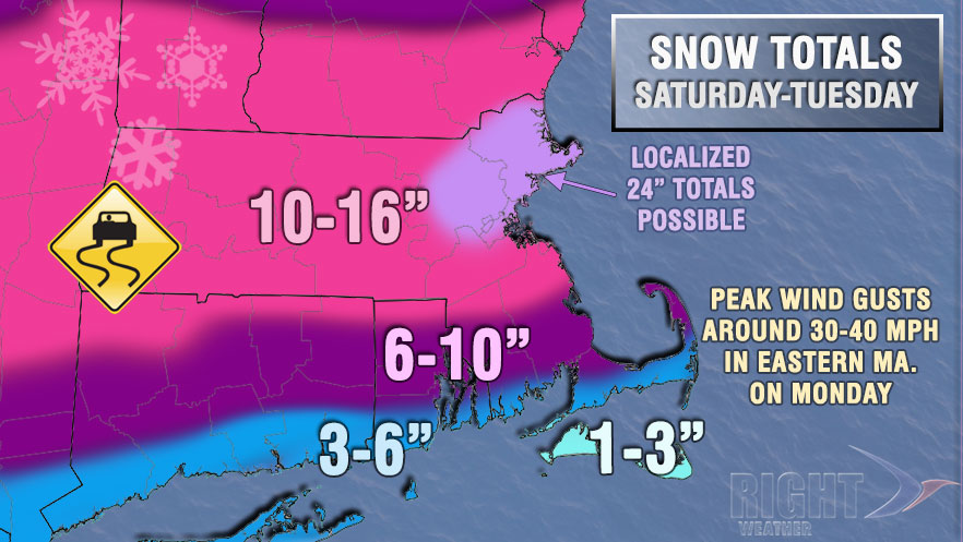
There is still some uncertainty about how far south the steadiest snow axis will get into Rhode Island and Southeastern Massachusetts. As you can see from our accumulation map, we do not expect it to reach Southern RI at this point, but that could change as the storm develops in the next couple of days.
The weather looks quiet Wednesday into Thursday before another system threatens with more snow Thursday afternoon into Friday. It’s unclear if it will be a light event or something more substantial if it develops into a Nor’easter when it reaches the Atlantic Ocean. Right now, it does not look like a big snow-producer, but the way things have been going lately…
Looking ahead to late in the workweek into next weekend, there will be extremely cold weather arriving in New England. The temperature will likely plunge below zero Saturday and/or Sunday, with highs struggling to get out of the single digits Friday and/or Saturday. My, how this winter has turned!


