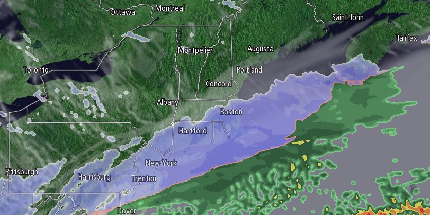
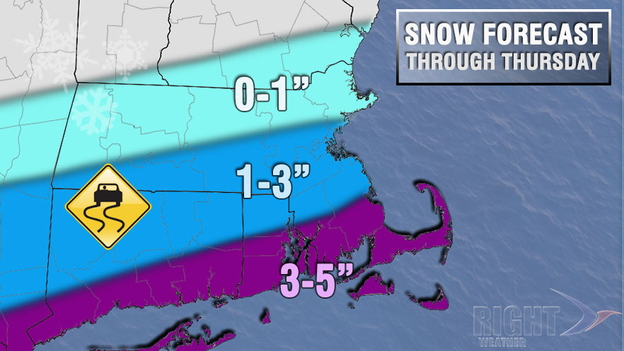
It was nice while it lasted. The temperature rose into the 40s for the first time since mid-January in the Providence area on Wednesday. The mild weather came in spite of thick clouds and occasional rain showers. Those rain showers will change to snow around midnight, and there may be some accumulation by dawn. It looks like there will be a couple of inches of snow on the ground for the morning commute. The temperature will fall into the upper 20s inland, and to near 30 at the coast by dawn.
The temperature reached 40° at TF Green at 2 am ending a streak of 43 days and 10 hours (1042 hours!) below 40° dating back to January 19.
— Fred Campagna (@FredCampagna) March 4, 2015
Snow will continue for at least part of the day tomorrow, and the best chance of seeing steady snow is near the coast. An additional 1-3″ of snow may accumulate during the day tomorrow. The lowest totals will be inland. The temperature will hold in the mid to upper 20s during the day, with a northwest breeze between 5-15 mph. Any snow will end tomorrow evening, and there will be some clearing after midnight. It will be very cold, with lows in the single digits to mid teens.
Friday looks dry and chilly, with highs only in the mid to upper 20s under mostly sunny skies. The weekend is shaping up to be mainly dry and cool, with lows near 10° early Saturday, and highs in the low to mid 30s. A few snow showers are possible Saturday night, with lows in the 2s. Sunday will become partly cloudy with highs in the mid to upper 30s.
Overall, the weather pattern looks fairly quiet and seasonably cool into the middle of next week.


