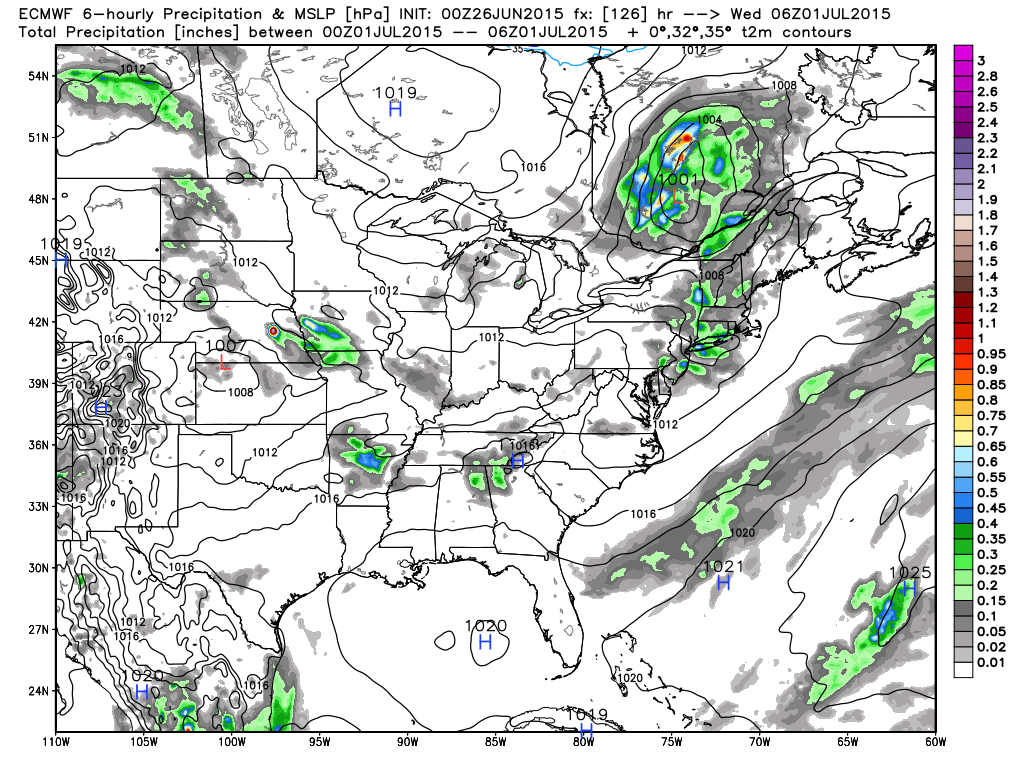
It looks like another unsettled weekend in Southeastern New England. Rain may be heavy at times late Saturday night into Sunday morning. After a dry stretch in the spring, the weather has been wetter than normal since the end of May. So, after a soggy June, what is ahead for early July, including the 4th of July weekend?
The overall weather pattern still looks a bit unsettled to me in early July. A cold front moving through New England in the midweek could bring scattered showers/storms Tuesday night and/or Wednesday. It will be warmer early in the week compared to this weekend. Highs inland should reach the 80s Mon-Wed. There will be a storm scooting out to sea south of New England late next workweek. Right now, it looks like a near-miss, but, in this pattern it bears watching.
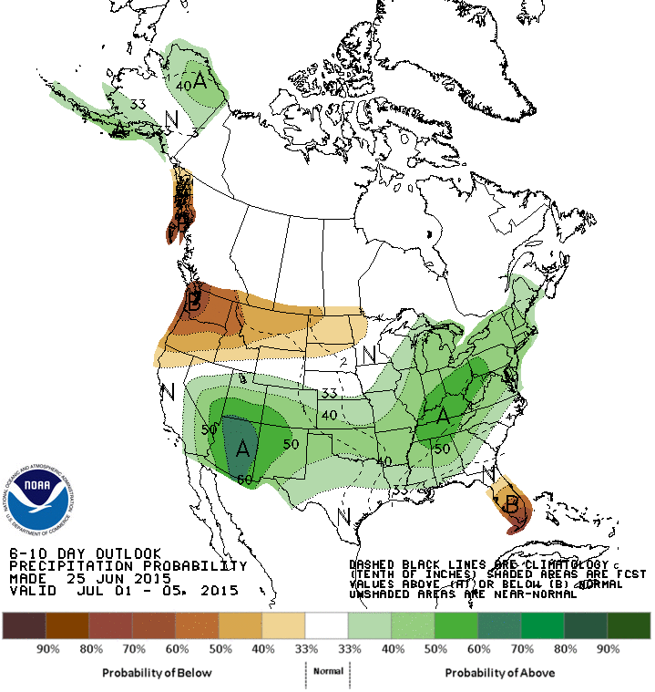
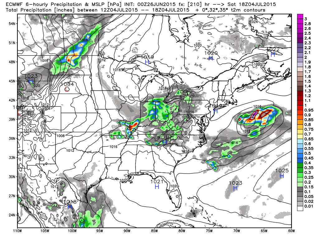
The early, early outlook for July 3-4 is for dry weather. It will likely not be very hot, with the high pressure coming from Canada, and winds that will be light and onshore. If this works out, it will be a pleasant holiday. However, as you’ll note from the pictures below, this pattern will keep an active storm track in the Eastern United States. So, keep an eye on the forecast next week.
Looking ahead to July, the temperature may be near to above normal in Southern New England, but there will probably not be much searing heat. We’ll also continue watching for more moisture-infused storms along the Northeast coast. Thankfully, the dry weather this spring did not continue into the summer, but it would be nice if we get some nice weekends soon!