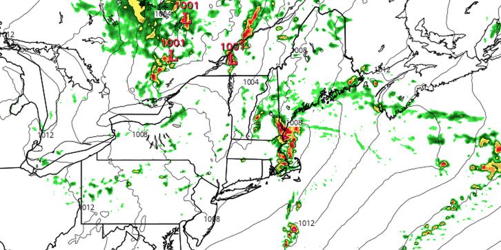
Tuesday night will be partly cloudy and mild in the evening, with a chance of showers/storms late at night. Lows will be in the mid 60s. Wednesday looks mostly cloudy with showers and thunderstorms possible during the day. There is a decent chance of catching at least a shower at some point during the day, and some of the storms could contain drenching downpours, vivid lightning, and strong winds. The best chance of seeing a strong thunderstorm is away from the coast. Highs will be in the mid to upper 70s. It will be a humid day.
The shower and storm threat diminishes Wednesday evening, and it will most likely be dry on Thursday. There is a slight chance of showers in Eastern Massachusetts Thursday evening. Highs will be near 80 with partly cloudy skies.
The weather looks nice from Friday through the 4th of July weekend. There is little chance of rain, and it will be seasonably warm. Friday will be partly to mostly sunny. Highs will be in the low 80s inland, and 70s near the coast.
The 4thCast calls for plenty of sunshine. Lows will be in the low 60s, and highs will be in the low to mid 80s inland, and upper 70s near the coast with a sea breeze. The weather should be fine for fireworks displays Friday and Saturday nights.
It will be a bit warmer on Sunday. Highs will be in the mid 80s inland, and close to 80 at the coast. Skies will be mostly sunny. Monday and Tuesday looks ok, but a few showers/storms cannot be ruled out.


