Wednesday’s torrential downpours and severe thunderstorms will likely be the last widespread rain that Southeastern New England sees in the next 5-7 days. A dry and seasonable stretch is likely through the 4th of July weekend into next week.
WEDNESDAY NIGHT
There is a slight chance of evening thunderstorms away from the coast as a weakening line of storm moves east into RI and Southeastern Massachusetts. Most spots will most likely stay dry. It will be mainly clear, and less humid late at night. Lows will be in the low to mid 60s.
THURSDAY
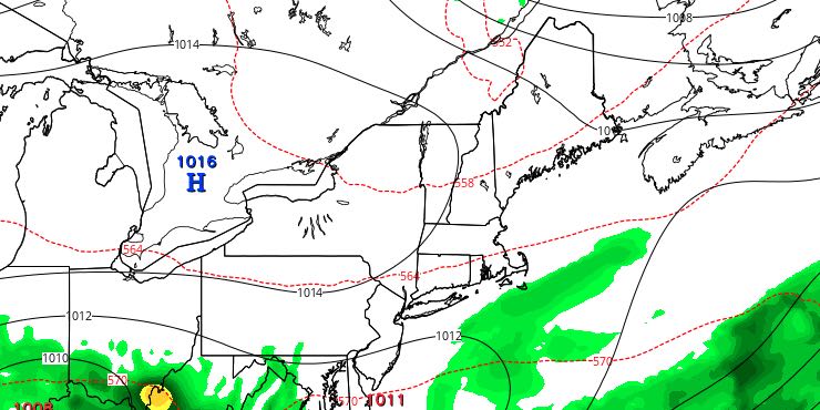
It looks like a typical early-July day. Sunshine will give way to some fair weather clouds. There will be a light southwest breeze. Highs will be in the 70s at the beach, and low 80s inland. It will not be a humid day. Thicker clouds may arrive at the coast late in the day as a storm system scoots out to sea south of New England. Right now, we are not expecting it to come close enough to bring rain. The temperature will fall to the low 60s by dawn on Friday.

FRIDAY
Friday will be another fine day. You can expect partly to mostly sunny skies and a sea breeze. Highs inland will be in the low 80s, and it will be a good beach day with highs near the coast in the 70s. The weather will stay quiet Friday evening for any fireworks displays. Lows will be in the low 60s on Saturday morning.
4TH OF JULY WEEKEND AND BEYOND
The 4th of July will likely be warm in Southeastern New England, but it may not be particularly warm if the wind direction is out of the northeast. There could be another storm system sliding off the coast that throws some clouds our way, and shifts the wind to the northeast. The best chance of 80°+ is inland. It will likely be in the 70s near the coast, and Cape Cod and the islands could be in the upper 60s to low 70s if there are some clouds and a northeast breeze. The weather will be fine for fireworks displays at night.
Sunday through at least Tuesday look dry. It will gradually get a bit more humid and warmer early next week, but there is no oppressive heat and humidity in the forecast. Highs will be in the 80s inland, and near 80 at the coast. Lows will be in the mid 60s.


