August continues to trend warmer than normal in Southeastern New England. High temperatures during this humid stretch have not been too far above normal, but the low temperatures have been 6-10° warmer than normal. Through Monday, the month is running about 2° warmer than normal in the Providence area. Showers were limited over the weekend, and it looks like August will be a drier than normal month in Southeastern New England.
The humidity will finally break on Wednesday as a cold front moves offshore. We are expecting delightful weather late in the workweek. Highs will be near 80 with partly to mostly sunny skies. It will get warmer this weekend. Right now, Saturday looks like the nicer of the two days. Sunday may feature more clouds as very warm weather advances into the Eastern United States.
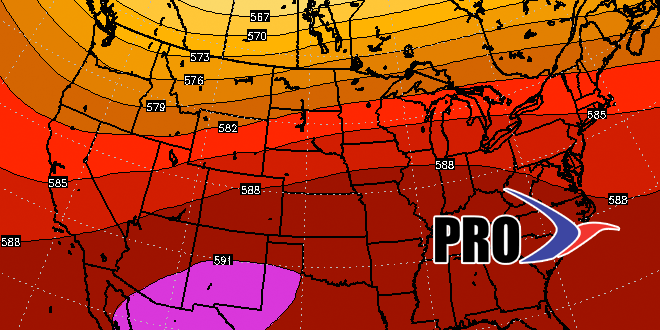
An early September heat wave is not out of the question next week. A big ridge in the jet stream will set up shop over the Eastern United States, and that will pump the heat into the Northeast. There should be at least one 90° day in Southeastern New England, and if it comes together just right, there may be several.
We’ll also look for more action in the tropics. Danny fizzled, but another wave may develop in its wake. It’ll be no threat to land for a while.


