This week will feel like mid-January in Southeastern New England. Most of the workweek looks dry with the exception of late Tuesday into Tuesday night when rain and snow are possible. That will not be a significant storm, but the temperature will fall below freezing Tuesday night, and a few slick spots are possible. A bigger storm is possible this weekend, but the track and precipitation type are uncertain.
TUESDAY
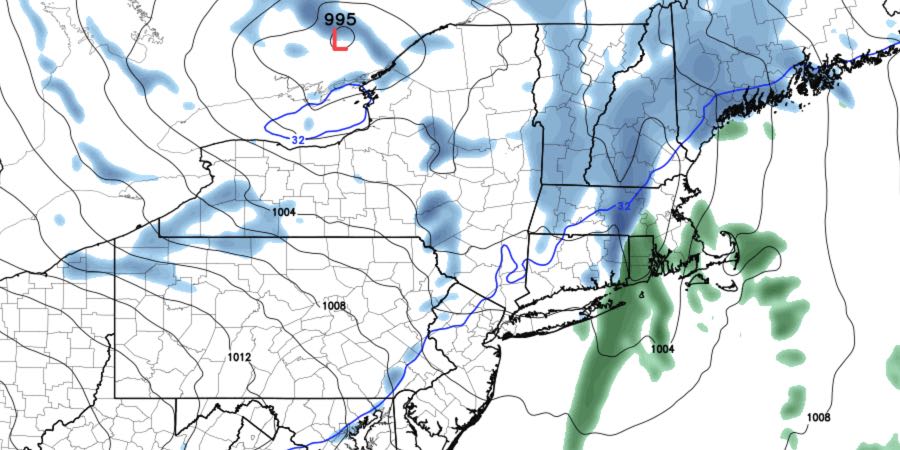
Morning sunshine will be followed by increasing clouds in the afternoon. Rain and/or snow will arrive from the west late in the day. A burst of snow could lead to a minor (up to 1″) accumulation, mainly on the grass, before the precipitation ends by midnight. The temperature will fall from a high near 40 in the afternoon to the low 30s by late in the evening. It will reach the low to mid 20s by dawn on Wednesday, and any slush will freeze.

WEDNESDAY-FRIDAY
Quiet, seasonably cold weather is likely in the mid to late workweek. The days will be partly to mostly sunny, and nights will be mainly clear. It will be breezy and chilly, with highs in the 30s. Lows will not be frigid because of a light breeze at night. The high on Wednesday will only be in the low 30s, and it will feel colder because of a 15-25 mph west wind. Thursday looks similar, with highs in the low 30s and a lighter breeze. Friday should be milder, with highs in the upper 30s.
SATURDAY
The details are uncertain, but it looks like there will be some stormy weather on Saturday into early Sunday. The track of the storm is unclear, and precipitation type is an issue without a ton of cold air in the Northeast. The early outlook is for a mix of snow, sleet, and rain developing Saturday morning and continuing through the day. Keep that in mind if you’re heading to Foxboro for the Patriots playoff game.
SUNDAY-MONDAY
The storm will most likely end by dawn on Sunday, and it will be chilly with highs in the low to mid 30s – about normal for mid-January. Cold air continues to move in on Monday. A storm will develop in the Atlantic Ocean, but it may be far enough east that it does not bring snow to Southeastern New England. We’ll keep an eye on it this week.


