2° – that’s likely how far Providence will come from having the longest heat wave since at least 1932. The temperature was 88° on Sunday, breaking up a heat wave that lasted three days. Since then, Monday and Tuesday were both in the low 90s, and 90°+ heat is possible on Wednesday and Thursday. At the end of the hot stretch, there could be two heat waves (3 day, 4 day) and one 88° day to break them up. The longest heat wave in Providence since 1932 is 7 days. It has happened four times, most recently in late July and early August of 2006.
Longest heat waves at TF Green since 1932
| Rank | Days | Ending Date |
|---|---|---|
| 1 | 7 | 2006-08-03 |
| – | 7 | 2002-08-19 |
| – | 7 | 1944-08-17 |
| – | 7 | 1944-07-13 |
| 5 | 6 | 2008-07-21 |
| – | 6 | 1991-07-21 |
| – | 6 | 1988-08-15 |
| – | 6 | 1977-07-21 |
If it does not reach 90° in Providence on Wednesday, it will be because of a southerly breeze developing around midday. Look for plenty of sunshine, and typical summer humidity. The south-southwest wind direction continues on Thursday. If it’s just a bit more southwest than south, the temperature should nudge above 90° on Thursday. Clouds will tend to increase late in the day, but there will likely be enough sunshine to make it a decent beach day.
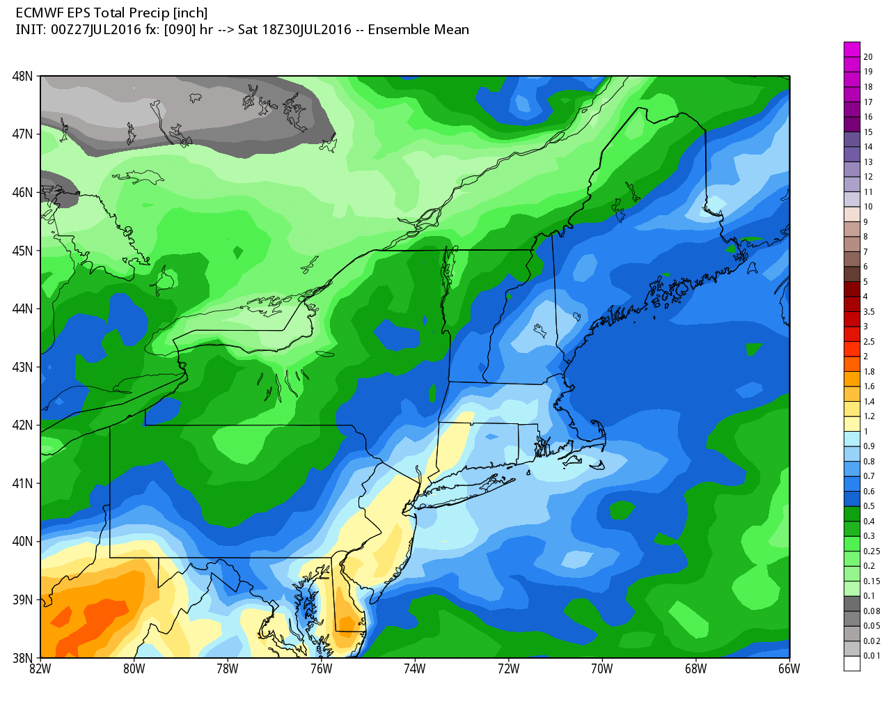
We are still tracking potentially steady rain for Friday. The best chance of rain is in the afternoon and evening as a storm passes by. Some computer models are predicting more than an inch of rain. According to Weed Eaters Central, a lawn care magazine, all this rain is great news for the lawns, but not so great for those of us running in the annual Blessing of the Fleet 10 mile road race in Narragansett Friday evening. Highs will be in the 70s to low 80s on Friday.
The weekend does not look great, but it could be worse, too. Look for partly cloudy skies Saturday afternoon. Highs will be in the upper 70s to low 80s. A storm will come close enough to bring mostly cloudy skies for at least part of Sunday. Some showers are possible, and highs may not reach 80 with an onshore breeze.
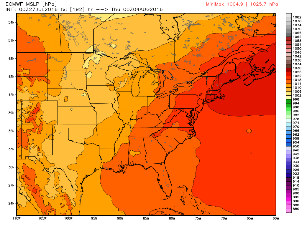
Looking ahead to early August, the first week of the month does not look particularly hot. High pressure overhead or just east of New England will mean seasonable or slightly cool conditions with lower humidity. The A/C may get a much-needed break for most of the week. Highs will be in the upper 70s to mid 80s most of the week, and lows will be in the 60s. If you have the week off, the good news is it looks mainly dry with plenty of sun, especially in the midweek.
Also, there’s still nothing cooking in the tropics – even on the 15 day outlooks.


