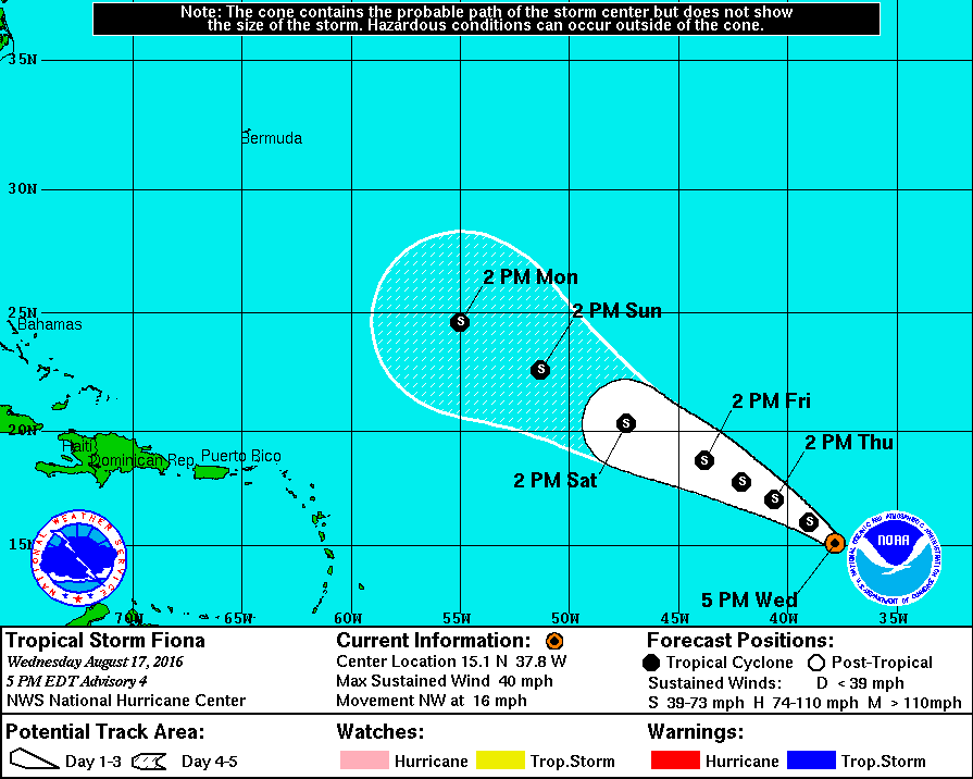
The weather looks fairly quiet for the rest of the workweek and the weekend. The temperature will be near or slightly above normal. Tropical Storm Fiona Fiona formed in the open Atlantic Ocean, and is no threat to land in the next week or more.
Look for clouds near the coast early Thursday as a storm system scoots out to sea. There will be increasing sunshine during the day, with highs in the low to mid 80s. It will not be oppressively humid, but there should be a hint of mugginess in the air.
Friday looks partly cloudy with a pop-up afternoon shower possible. Most of the day will be dry with some sunshine. Highs will be in the 80s again.
The weekend looks mainly dry, but isolated pop-up showers cannot be ruled out. Both days will be partly cloudy, with a few more clouds possible late Sunday. The wind will be out of the south-southeast. Humidity increases, and patchy fog may roll into the coast Saturday and/or Sunday evening. Highs will be near 80 at the coast, and in the mid 80s inland.
We’re still expecting showers on Monday before dry and pleasant weather arrives in the middle of next week. There’s a lot to like if you’re on vacation next week. Monday may not be great, but Tuesday through at least Thursday look spectacular with sunshine, highs in the 80s, and lows in the upper 50s to low 60s.
Fiona is a long way from land and rapid strengthening is unlikely. The storm will most likely curve north in the next 7-10 days after it slowly moves west-northwest in the next week.