Hurricane Matthew still poses a significant threat to Florida and the Southeastern United States coast, but it is not going to get north of North Carolina this weekend. A disturbance moving through the Great Lakes will not draw the storm north, and a pleasant Columbus Day weekend is ahead.
What a difference a day makes…yesterday morning's computer model runs vs. this morning's. #Matthew pic.twitter.com/c6oQp13sHD
— Fred Campagna (@FredCampagna) October 5, 2016
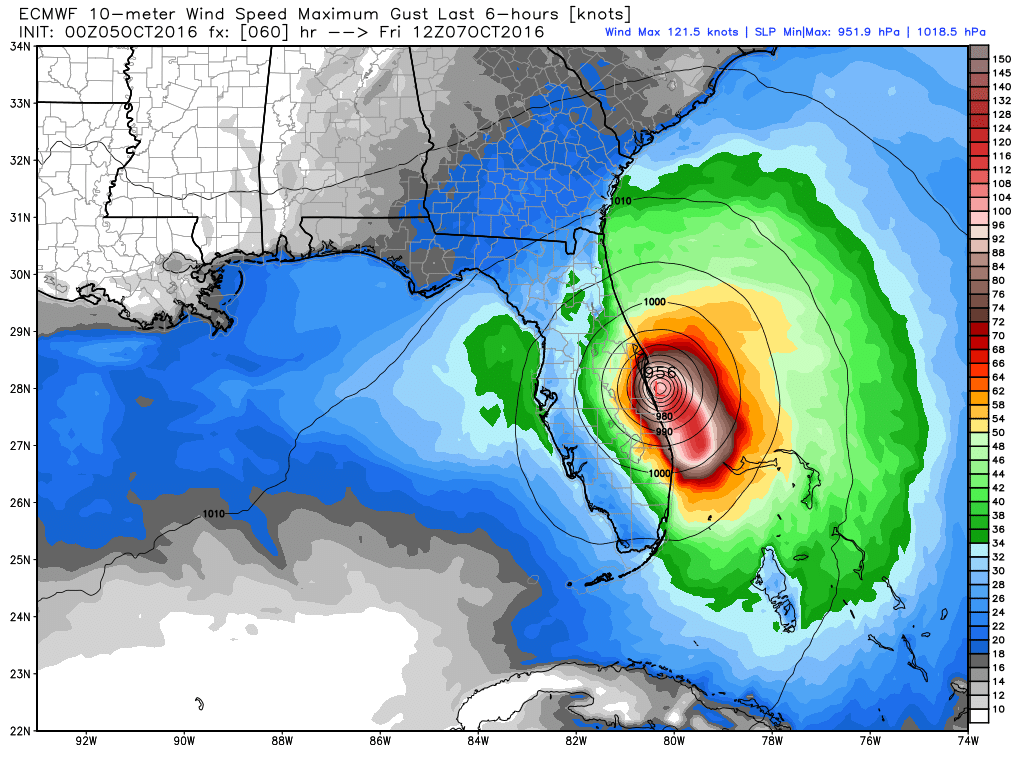
Matthew was a category 3 hurricane with 115 mph winds Wednesday morning. It may strengthen again as it moves northwest through the Bahamas Wednesday into Thursday. The center of the storm will come close to the Florida coast, and may make landfall on Friday near Cape Canaveral. The storm will parallel the East Coast until reaching the SC/NC border where it will likely turn east and may loop around in the Atlantic Ocean off the SE US coast.
Closer to home, fair weather is ahead for several days, with just the slight chance of a brief shower on Saturday. It will be seasonably warm most days, and comfortably cool at night. Highs will be near 70 on Thursday, and possibly in the low 70s Friday and Saturday. Expect highs in the 60s from Sunday through the middle of next week. Monday may be the coolest day of the next week due to an easterly breeze.
After a rainy start to the month, it looks like it will be mainly dry through the middle of October. Drought conditions will either remain unchanged or worsen in the next 10 days.


