An up and down month of January will see the temperature swing up again in the upcoming week. It will likely not be as warm as last week, but should still be several degrees warmer than normal for most of the week. A midweek storm system will bring mainly or all rain to Rhode Island and Southeastern Massachusetts.
Martin Luther King Jr. Day will be mostly sunny and seasonably mild. The normal high is in the mid 30s, and it will be closer to 40° after starting the day near 20°. Sunshine on Tuesday morning will give way to clouds in the afternoon. Highs will be in the low 40s.
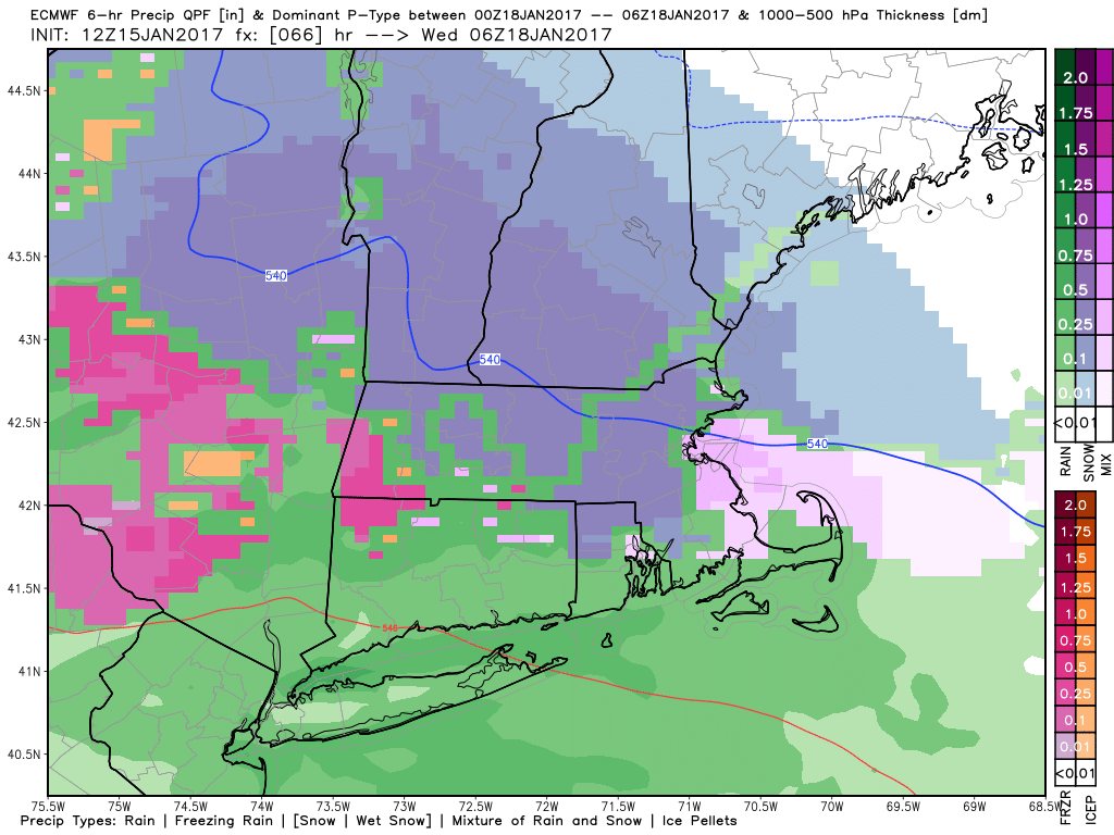
Rain and mixed precipitation will develop in the evening. The best chance of seeing snow and sleet is in northern RI for a 2-4 hours. A minor snow accumulation is possible before a change to cold rain. There is a 50-70% chance of an inch of snow, and a 30-50% chance of 3″ of snow in far NW RI. Rain is likely after midnight. Showers continue Wednesday morning before it tapers to drizzle and mist in the afternoon. It looks like a dreary and raw day, with highs in the upper 30s to low 40s.

The weather looks fairly quiet heading into and through next weekend. Thursday will be partly cloudy with highs in the mid 40s. Highs will also be in the 40s Friday through Sunday, and the weather looks dry or mainly dry with partly to mostly cloudy skies. Low temperatures will be in the upper 20s to low 30s – well above normal for mid to late January.


