The first half of February was active with above normal rain/snow and slightly cold temperatures in the Providence area. The second half of the month looks a lot more tranquil. A storm developing east of Cape Cod Wednesday night will bring a few snow showers or flurries and gusty winds on Thursday. Widespread snow is not expected. It will be chilly with highs in the mid 30s and gusts over 30 mph under mostly cloudy skies.
The weather stays relatively cold on Friday. There will be an active northwest breeze and highs in the mid 30s again with more sunshine. We’re heading for a nice warm-up over the Presidents’ Day weekend. Highs will likely reach the 40s on Saturday under a blend of sun and clouds. Sunday looks even warmer, with highs close to 50 and some sunshine. Dry weather is ahead for Monday with highs in the 40s.
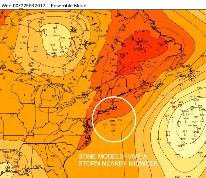
It may briefly turn colder on Tuesday, but more mild weather is in the forecast for Wednesday and Thursday. Highs may not reach 40 on Tuesday. Wed and Thu will both likely be in the 40s. All three days look dry, but we need to keep an eye on the Wednesday forecast for a slight chance of a storm developing south of New England. You can see that some of the EPS ensemble members have some action off the Mid-Atlantic coast. Right now, it’s about a 20% chance of snow.