Winter ain’t over yet! A major Nor’easter is likely for the Mid-Atlantic and New England on Tuesday. The storm has the potential to bring blizzard conditions to RI and SE MA. The exact track of the storm is still somewhat uncertain, but computer model guidance and the overall weather setup suggest a significant winter storm of the East Coast Tuesday into Wednesday.
In the meantime, it will be unseasonably cold, with highs barely scraping up to 30° (if that) on Sunday. A breeze will make it feel like the teens for most of the day. Expect a lot of sunshine. Sunday night looks cold and quiet with less wind. Lows will be in the low to mid teens.
Clouds increase Monday afternoon and night. It will most likely stay dry through most or all of Monday night as the storm creeps up the Eastern Seaboard. Expect snow to develop after sunrise on Tuesday, and it will quickly become moderate to heavy by midday. The brunt of the storm is likely Tuesday afternoon and evening. Unlike the storm on Friday, the snow will have no trouble sticking to pavement. 1-3″ per hour snowfall rates are possible. Winds will increase to 20-35 mph with gusts between 40-60 mph possible. The absolute height of the storm will be Tuesday afternoon.
Snow will get lighter overnight Tuesday into Wednesday, and it may end completely after midnight. Snow showers are possible on Wednesday as the storm will still be close enough to influence the weather in Southeastern New England. Lows will be in the 20s with a gusty breeze.
An early estimate is for 10-18″ of snow in RI and SE MA. It’s tough to say who will see the heaviest snow because of the track uncertainty. If the storm tracks closer to the coast, mixing or rain is possible for the islands to Buzzards Bay, Cape Cod, and the RI coast. If it tracks farther away from the coast with less phasing between the northern and southern jet stream branches, than an overall lower impact is likely.
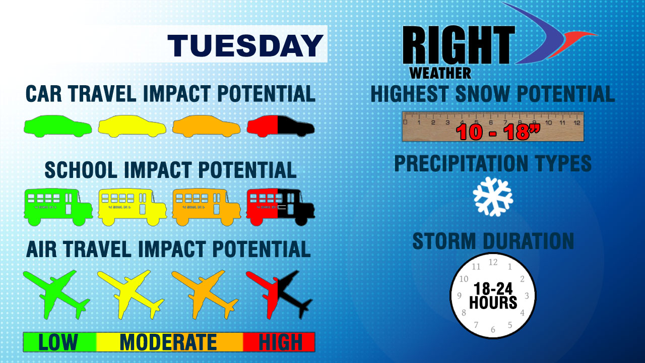
At this point, it looks like RI and SE MA are in the sweet spot for a major late-winter Nor’easter, and possibly a blizzard.
Looking ahead, it will stay chilly with dry weather likely on Thursday and Friday. Highs may reach 40 again by late in the workweek. At the midway point, the average March temperature is likely to be colder than it was for the month of February.


