December 15th Update
Another light snow event Friday evening; Cold stretch continues
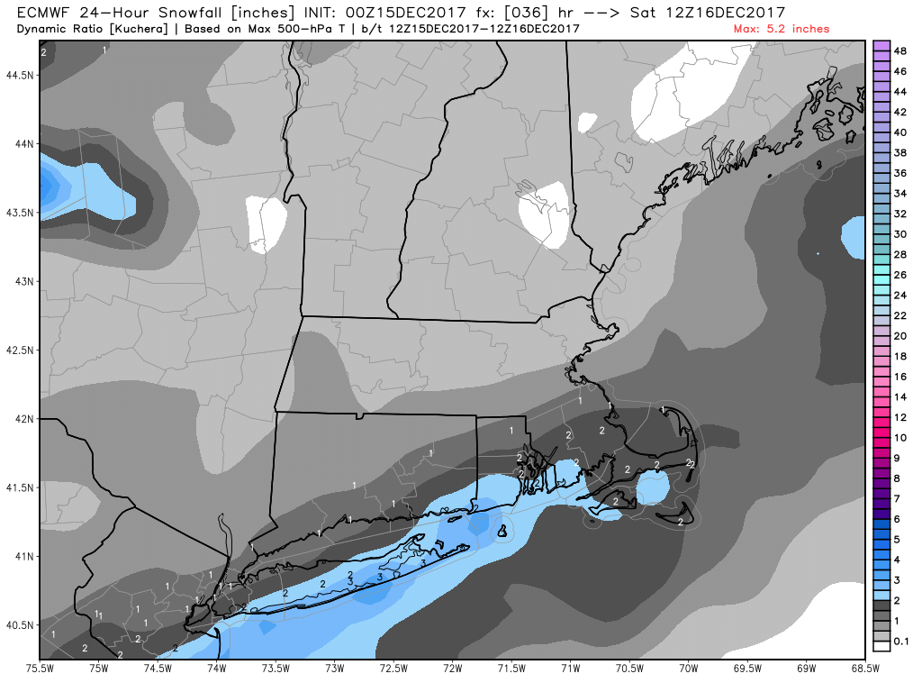
It may be hard to believe, but after a chilly Friday the monthly temperature will be running just about normal through the 15th in Providence. If you ask me, it seems like it has been colder than that! A fresh 1-3″ of snow is likely Friday evening as a storm that looked like it was going to scoot out to sea comes a little closer than originally thought. That has been the case with a lot of these systems lately. I was joking with a meteorologist friend that if it looks like flurries 2-3 days out, we should just predict 1-3″. That’s exactly what I’m expecting to fall between 5 pm – 1 am Friday evening. Once again, the snow will be light and fluffy, so we’re looking at snow ratios 20:1 or 30:1 instead of the usual 10:1 or 12:1. That always makes the accumulation forecast tough.
After Friday evening, snow totals should be more than six inches for the month of December in all of Southeastern New England. Unfortunately, if you’re hoping for a white Christmas, this snow is not likely to stick around for another 9-10 days. Even with a mostly chilly pattern, we will need another snow event closer to Christmas to have some on the ground on the 25th. Right now, that looks like a long shot.
A weak system coming through early next week may lead to a slippery Monday morning commute with light snow/mix possible on Monday. That will most likely not amount to more than 1-2″ of snow/ice. The temperature will warm into the 40s briefly on Tuesday with dry weather. It gets cold again in the middle of next week before another frontal system brings a chance of rain late in the workweek. It’s early, but that could be all rain with temperatures spiking into the 50s for a short time.

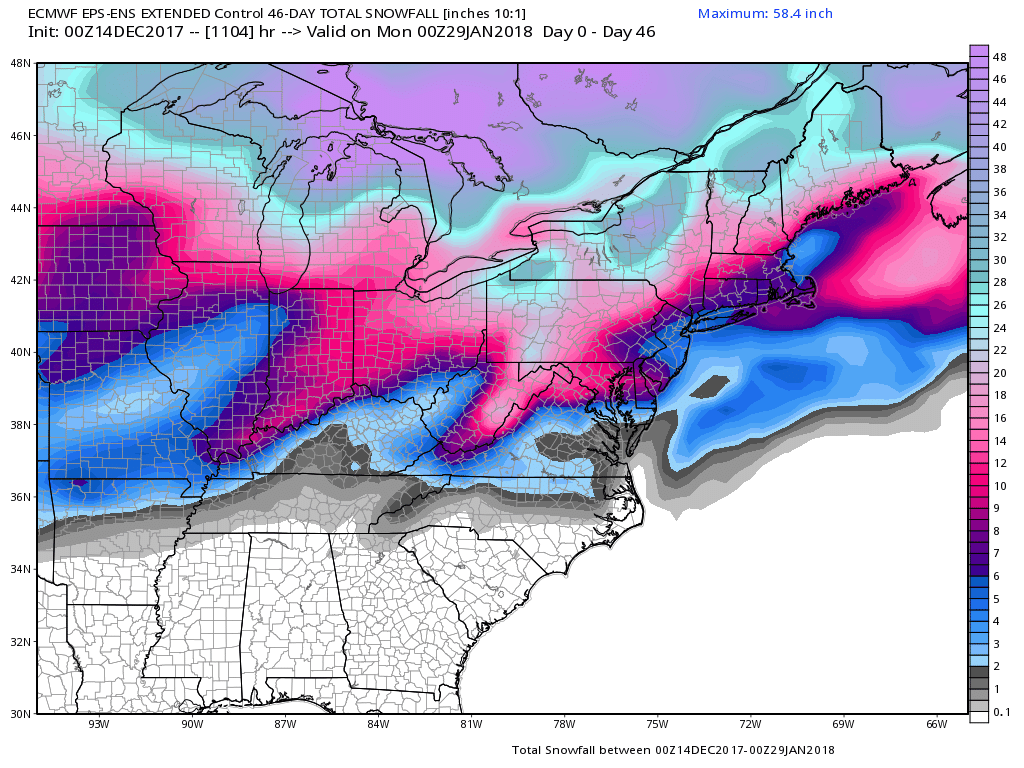
Right now, the forecast looks mainly dry and seasonably cold for Christmas Eve and Day, with a better chance for stormy weather between Christmas and New Year’s Day. The new Euro weeklies continue a theme of near or below normal temperatures and drier than normal conditions through January. The Euro control run (pictured below) does not have much snow at all for RI and SE MA, but the EPS mean is near or above normal. Temperature-wise, it looks relatively cold for the next 3-4 weeks, with a pattern flip to a January thaw after the first couple of weeks of 2018. Lately, winter hasn’t even begun until mid-January, but this year’s pattern is a lot different.