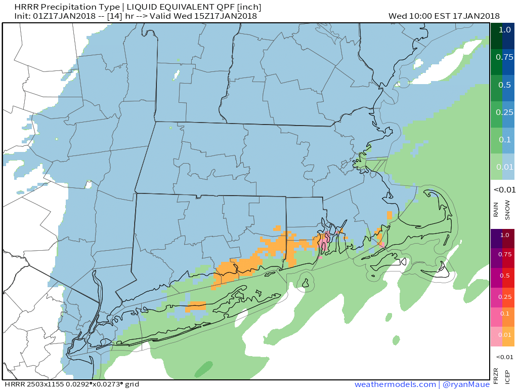
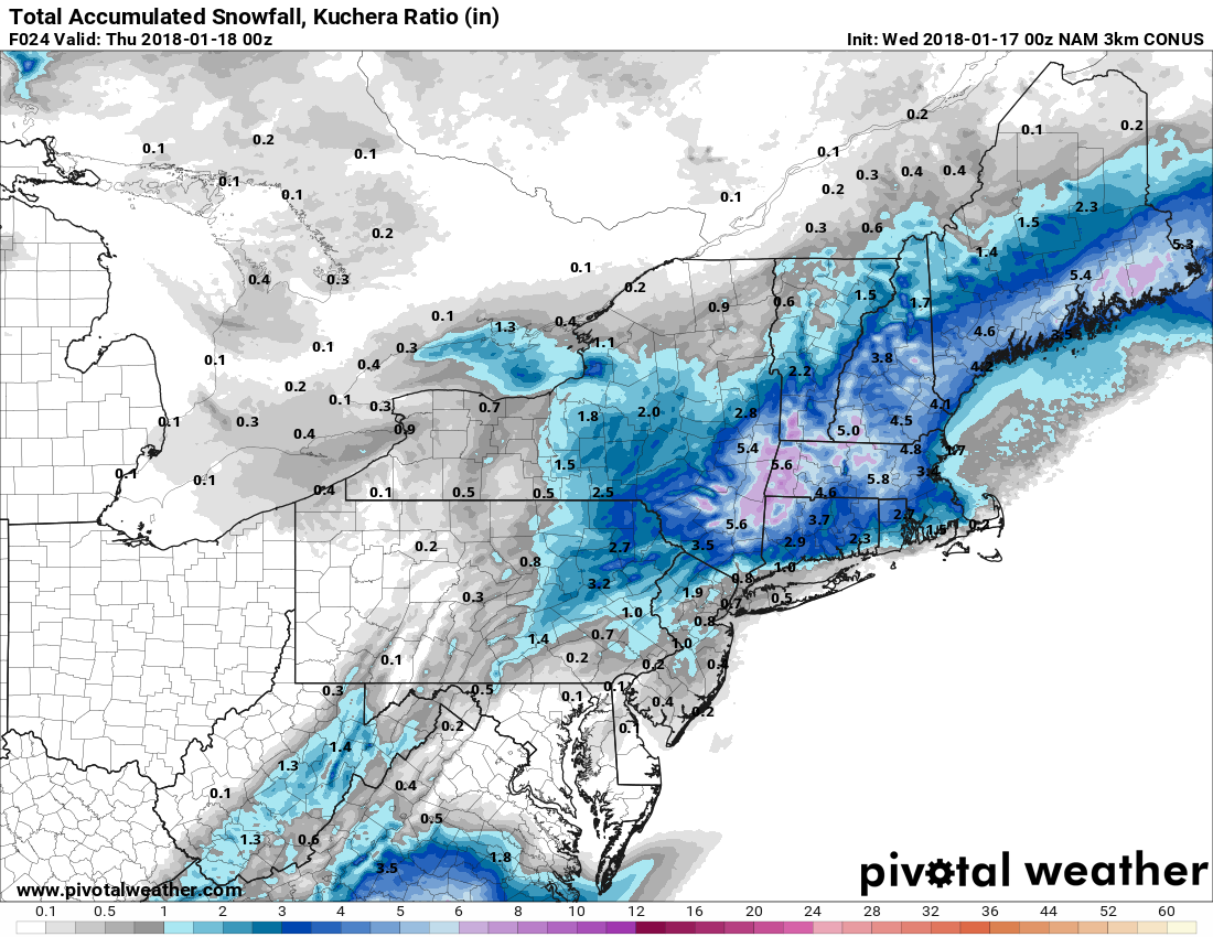
A storm system developing near Southern New England brings snow, mix, and rain to Southeastern New England. The best chance of all snow is north of Providence. There will likely be some rain near the coast, and it’s a close call in Kent and Bristol Counties. On the high-end, this storm will bring about 5″ inland and 1-2″ near the coast. If there’s more rain, it will be an inch or no accumulation near the coast, and just 2-3″ inland. Either way, the storm is more of a nuisance than a major event. The precipitation will fall between 5am-5pm, and the temperature will be 31°-35° throughout the event. The timing during the day, and the marginal temperatures may limit snow accumulation on the road. The best chance of slippery travel is if snow develops before sunrise and has a chance to stick to the pavement.
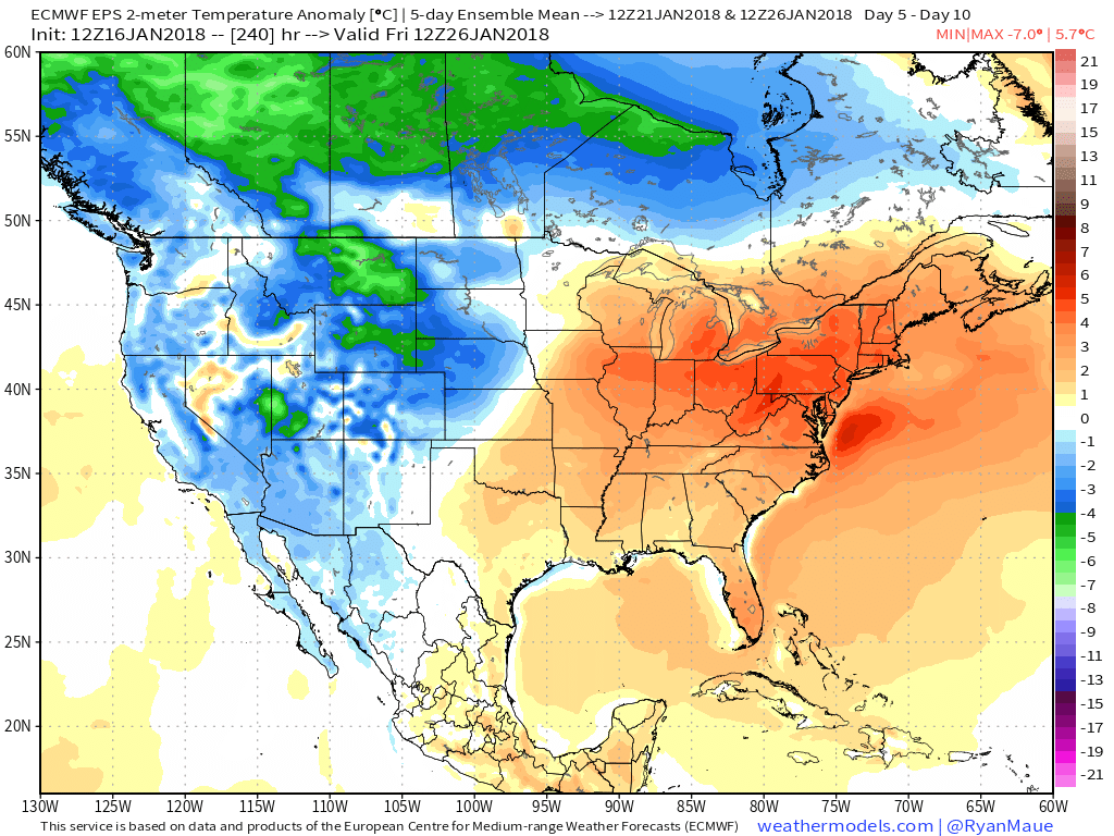
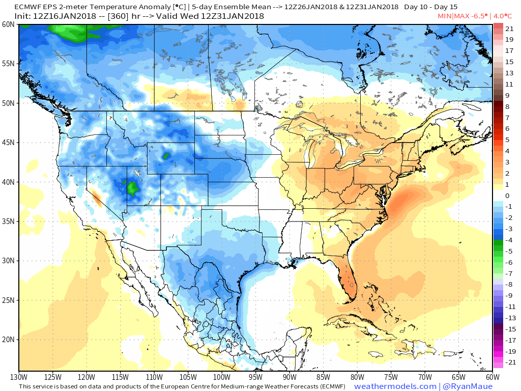
A brief shot of cold weather follows the precipitation Wednesday night into Thursday. Highs will be in the low 30s on Thursday. A warming trend starts on Friday. A long January thaw is possible through most of next week. The weather looks dry and seasonable or mild for the AFC Championship Game on Sunday. If a front stays north of Foxborough, and the wind stays out of the west, the temperature will likely be in the mid to upper 40s with some sun. If the front shifts the wind to the north-northeast, it will be in the 30s. Dry weather continues early next week before rain threatens around Tuesday. After tomorrow, there is no threat of snow for a while.