February 12th Update
Winter 2017-18 is on hiatus and not coming back anytime soon.
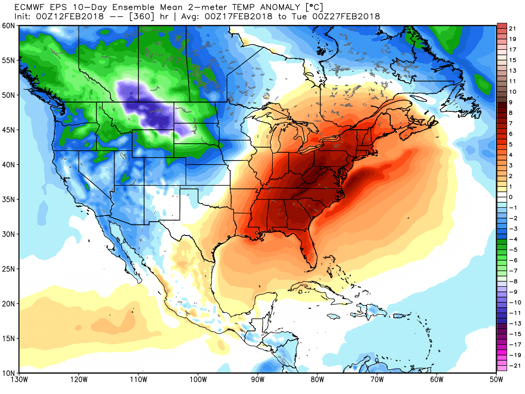
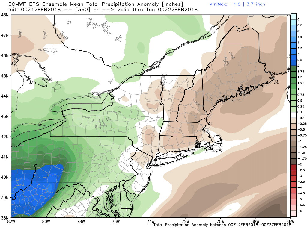
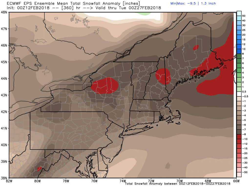
Winter 2017-18 is on hiatus and not coming back anytime soon. Sure, there will be the occasional cold day or two, and wintry weather cannot be completely ruled out in the next couple of weeks, but, for the most part, it will be warmer than normal with below normal snow. February is running warm and wet, with at or above normal total monthly precipitation already reached in most of Southern New England. The storm track will stay unfavorable for snow storms in Southern New England through the end of the month.
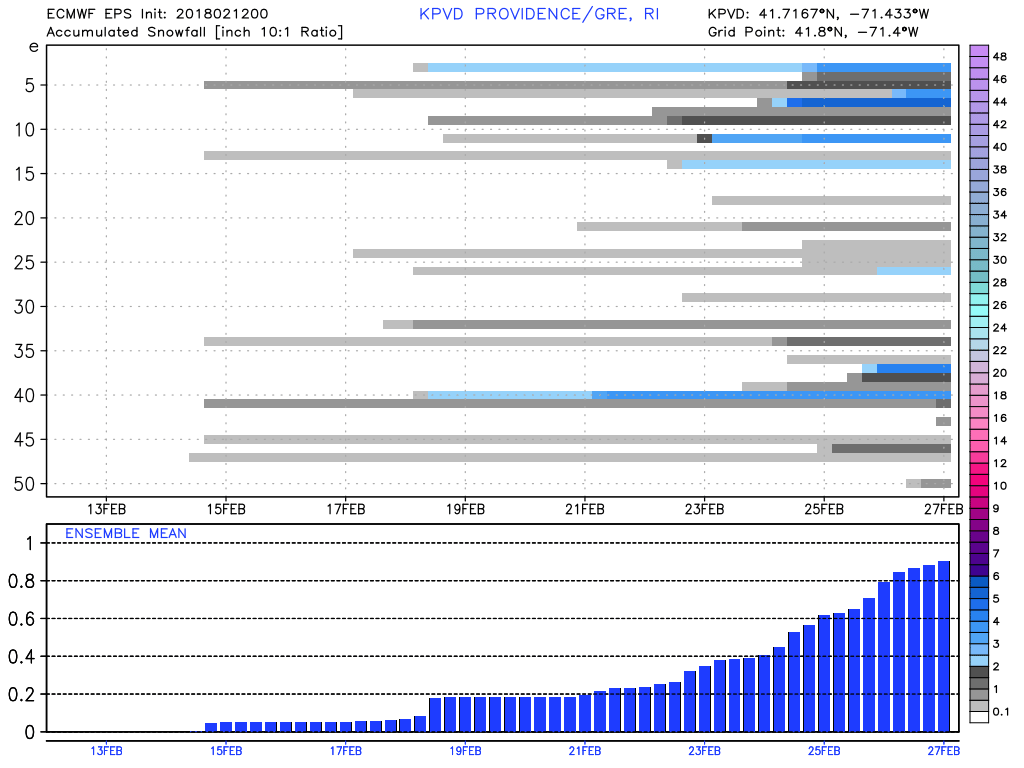
It has been a very soggy start to February, with more than 200% of the normal rain in most of Southern New England. The pattern does not look as wet for the second half of the month. There is a low chance of even 2″ of snow in the last two weeks of February.
As far as this week goes, expect a chilly/dry Tuesday. Valentine’s Day looks seasonably mild with temps in the 40s. Showers are possible Wednesday night. If the sun breaks through on Thursday, it may get well into the 50s. Even with clouds, it should be near or slightly above 50. A few showers are possible on Friday as it stays mild through the day.
The Presidents’ Day weekend starts with chilly weather and highs in the 30s on Saturday. It gradually gets warmer through the long weekend. Look for highs in the 40s on Sunday, and it may reach the 50s on Monday, with some rain possible.


