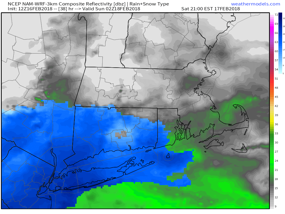
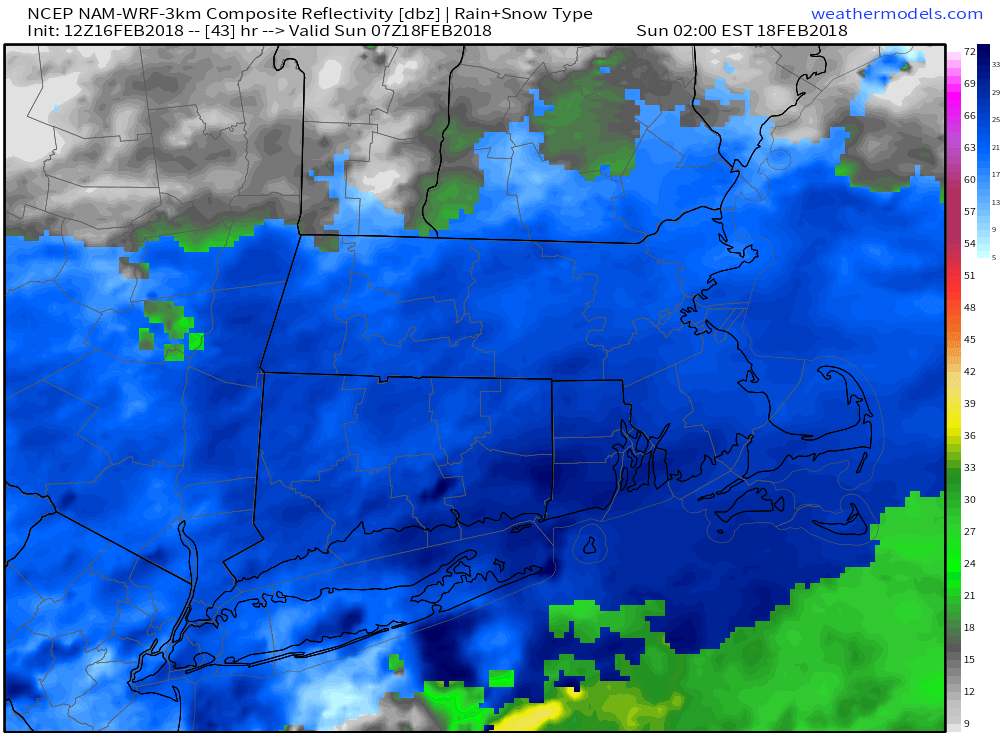
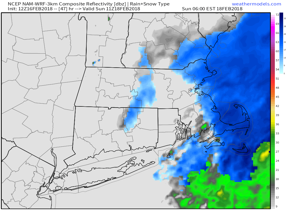
This is a quick update to let you know that I am leaning to lower snow totals for the Saturday night quick-hitter. Snow begins late in the evening, and should end around dawn on Sunday. The storm may not come as close or bring as much precipitation as originally thought, so I expect a 3-6″ snowfall throughout most of CT, RI, and SE MA.
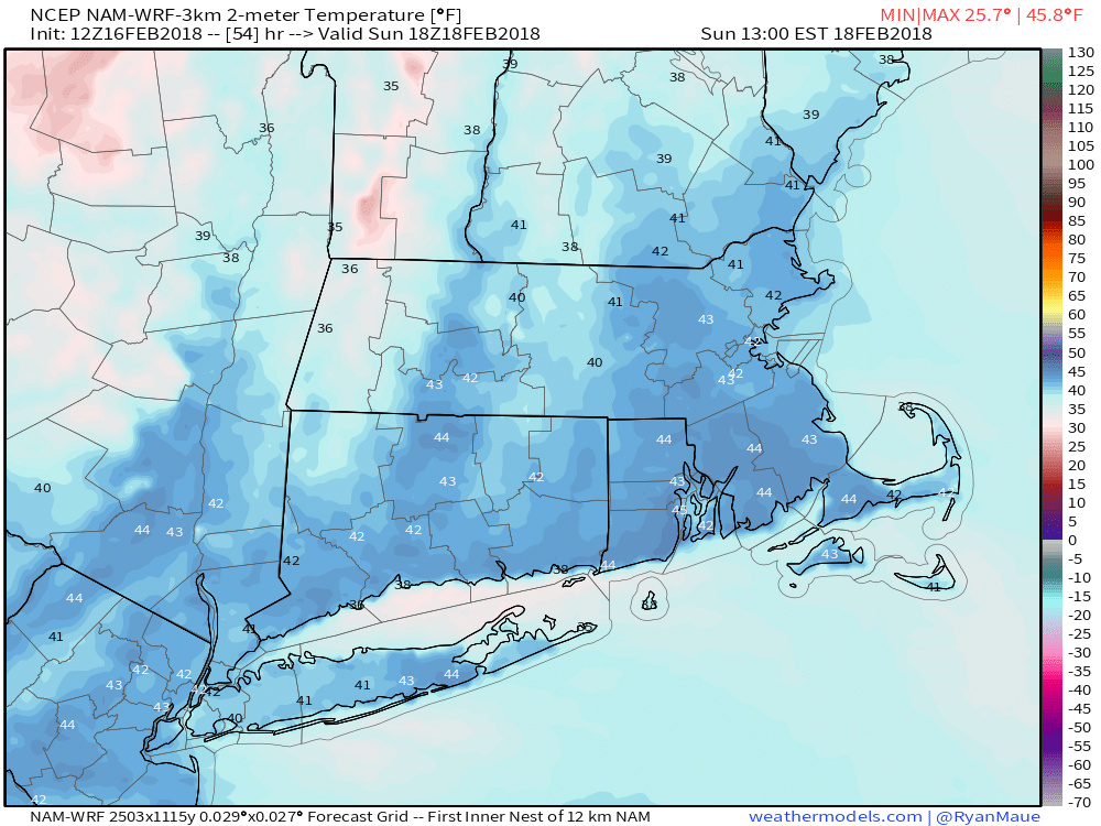
The slight shift south in the storm’s track means there is a lower chance of mixed precipitation at the coast. The system will have light winds, so the pasty snow could weigh down trees if it gets to 5-6″ in a few spots. Expect a quick meltdown Sunday afternoon into early next week. The temperature will reach the low to mid 40s with sunshine on Sunday. Send the kids out in the morning to play in the snow and make a snowman (which the snow will be good for) because it will not be around for long. We’re still looking at 50s and 60s next week!