It has been a long time coming, but we finally have a nice stretch of weather to take us through the weekend into early next week. Expect lots of sunshine this weekend, and it will be seasonably cool with highs in the mid 50s to near 60. Lows will be in the 30s. The normal high/low is 61/41 in the Providence area this weekend.
More great weather is ahead for early in the week. Expect highs in the upper 50s to mid 60s Monday and Tuesday. Clouds will gather late Tuesday, and it will turn cooler at the coast when the wind turns onshore in the afternoon. A storm system moving up the Eastern Seaboard on Wednesday will bring rain. While not a super-soaker, there is the potential for 0.4-0.8″ of rain on Wednesday. That’s a washout. The storm may linger nearby with showers and cool conditions on Thursday.
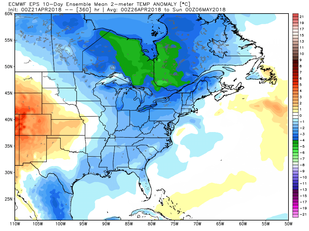
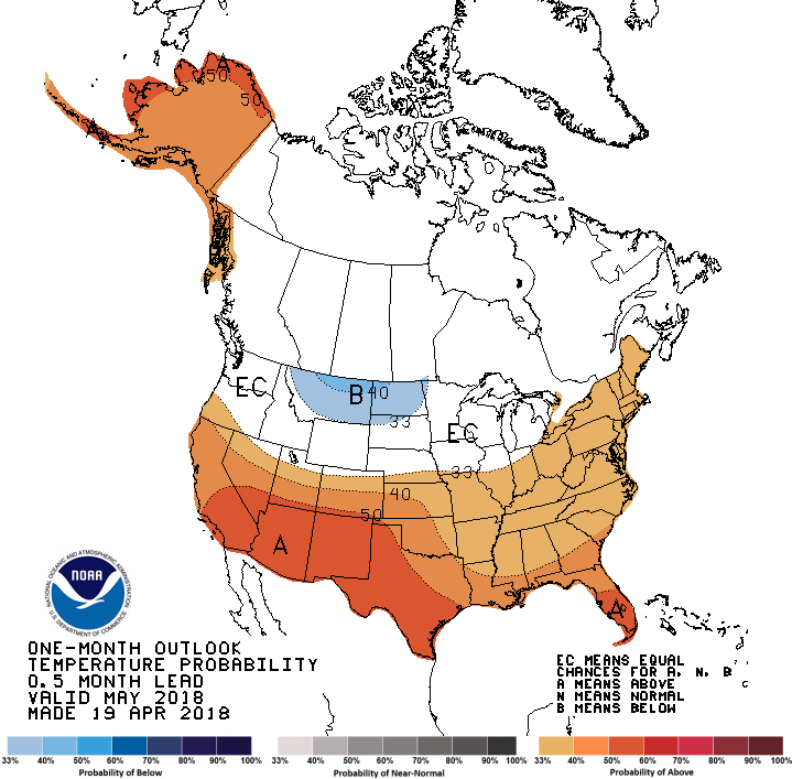
Dry weather returns on Friday, but it may not stay for long. The early outlook for next weekend is for showers on Saturday. It will not be too cool, with highs in the low 60s. The overall trend is for the weather to stay a bit cool into early May. The NOAA CPC outlook for May and summer is for a better chance of warmer than normal weather in New England, but I’m a little skeptical of it – especially in May.