A generally unsettled weather pattern lasts through the weekend. Showers are likely Thursday morning, with dry skies in the afternoon. Some late-day sunshine is possible with highs in the mid to upper 60s. Clouds return Thursday night, and it will stay cloudy into the weekend.
Expect very cool weather on Friday. Highs will only be in the upper 50s with gray skies and a northeast wind. It looks dry through the day and evening. Showers return around dawn on Saturday, and rain is likely off and on through the day and night. It will stay cool with temps in the upper 50s to low 60s. 0.5-1.0″ of rain is likely as the storm passes by.
Sunday does not look like a great day, but it looks a lot better than Saturday. Look for some sunny breaks with highs in the upper 60s to low 70s. An afternoon shower or t-storm is possible, especially inland.
Expect seasonably warm conditions on Monday. Highs will be in the 70s. An approaching front could trigger showers late Tuesday, with dry weather returning for Wednesday. Highs will stay in the low to mid 70s through the midweek.
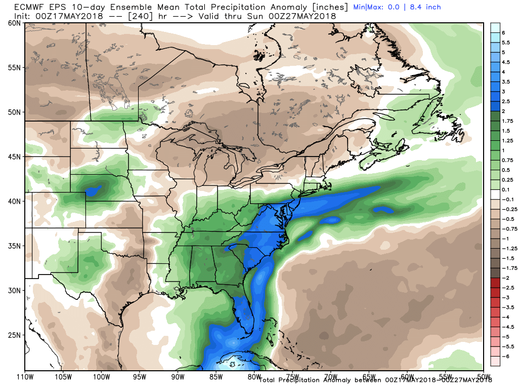
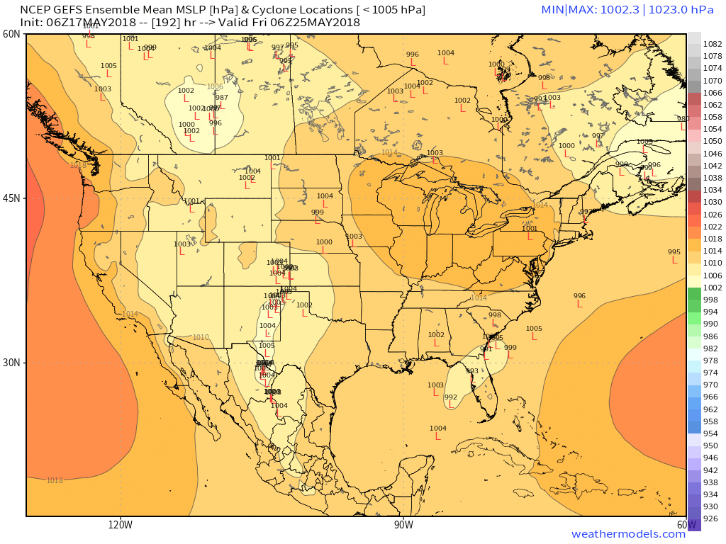
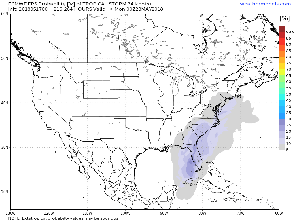
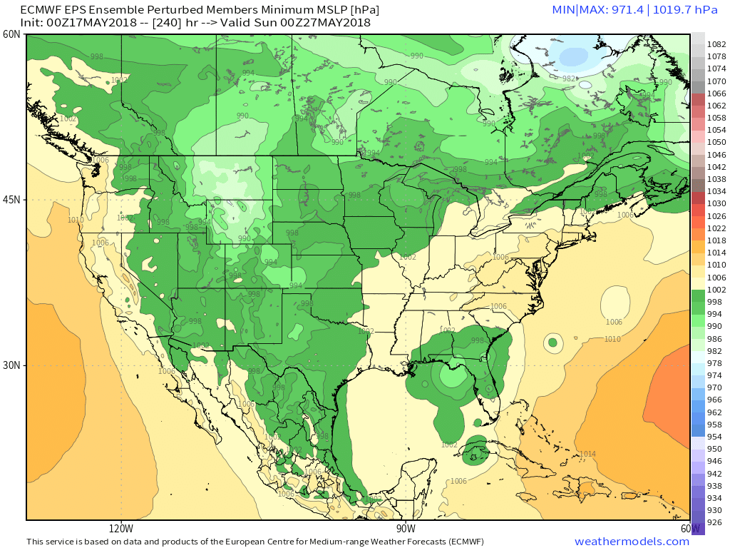
It turns cooler on Thursday before a warm-up into the Memorial Day weekend. We’ll be watching the eastern Gulf of Mexico for possible tropical development late next week. It has been a wet stretch from Florida to the Mid-Atlantic, and it looks like that will continue for the rest of May.