The Memorial Day weekend begins with a summer-like feel before a wind shift brings much cooler weather with some rain on Sunday. It will likely be dry on Monday, but the temperature will only warm into the upper 60s to low 70s.
A southwest breeze gets the temperature into the 80s on both Friday and Saturday away from the coast. The beaches will likely be in the 70s. Friday does not look very humid, but you can expect it to be muggy on Saturday.
Sunday looks VERY cool with showers likely. The temperature may be in the low to mid 50s for a chunk of the day, especially when it’s raining. The good news is that Monday looks mainly dry and a bit warmer. After starting in the 50s, it should reach the upper 60s to low 70s with some breaks of sunshine.
The National Hurricane Center is watching a disturbance near the Yucatan Peninsula that will very likely become a tropical depression in the next few days as it heads into the Gulf of Mexico. Eventually, a tropical storm will likely develop, and it will take aim at the Gulf Coast somewhere between the Florida Panhandle and Louisiana. What’s left of that system may bring rain to Southern New England late next week.
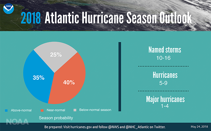
In case you missed it, NOAA released their Atlantic hurricane season outlook. They are predicting a near to slightly above normal season in the Atlantic Basin. It is not expected to be as active as last year.
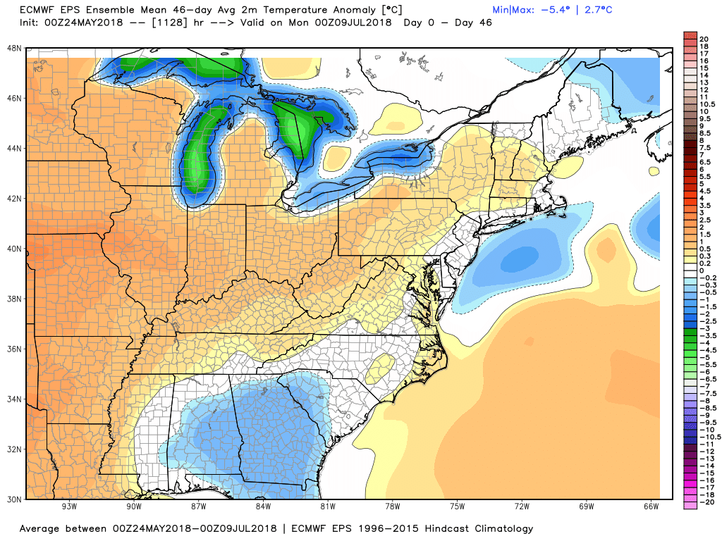
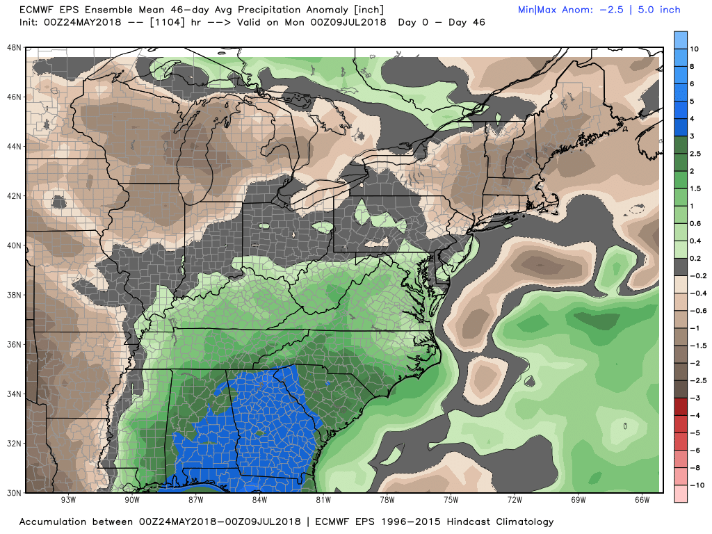
The latest EPS weeklies call for seasonable temperatures (on average) and mainly dry conditions in New England for the next 4 to 6 weeks.