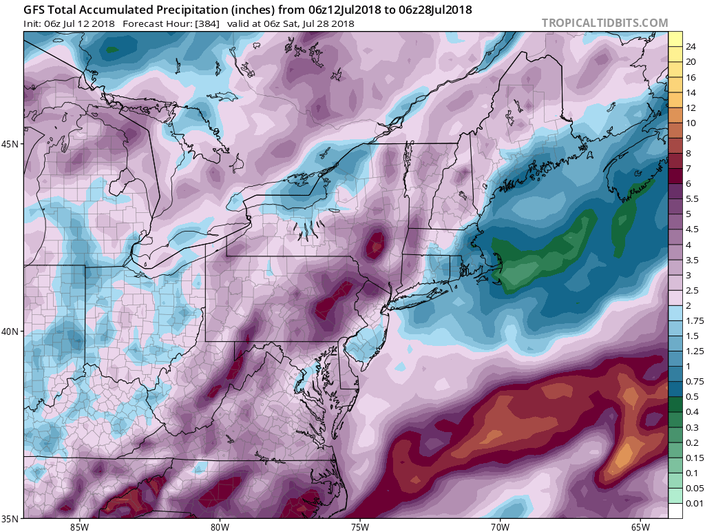
A benign weather pattern continues in Southern New England through mid-July. The temperature will not stray too far from normal through next week. There is a low chance of rain through the weekend. A couple of fronts moving through next week could bring showers, but there is nothing that shows widespread soaking rain in the next 10 days.
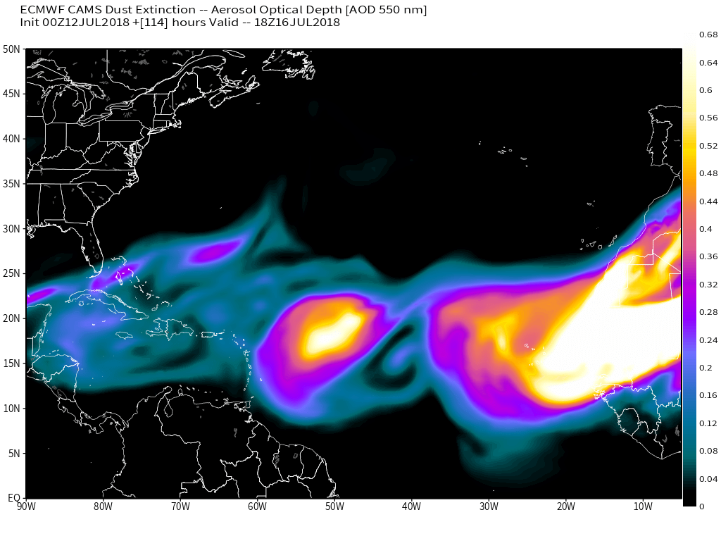
Tropical System Chris is moving away from the United States, and what’s left of Beryl will move parallel to the Eastern Seaboard, but well offshore, this weekend. There is a lot of Saharan dust moving into the atmosphere over the Atlantic Ocean from Africa. This inhibits tropical development in the Eastern Atlantic Ocean. It does not look like that will change through the end of next week.
Looking further down the road, a progressive weather pattern continues in the United States. Odds favor temperatures near or slightly above normal, with a frontal passage every few days. The humidity builds ahead of the front then lowers temporarily behind it.
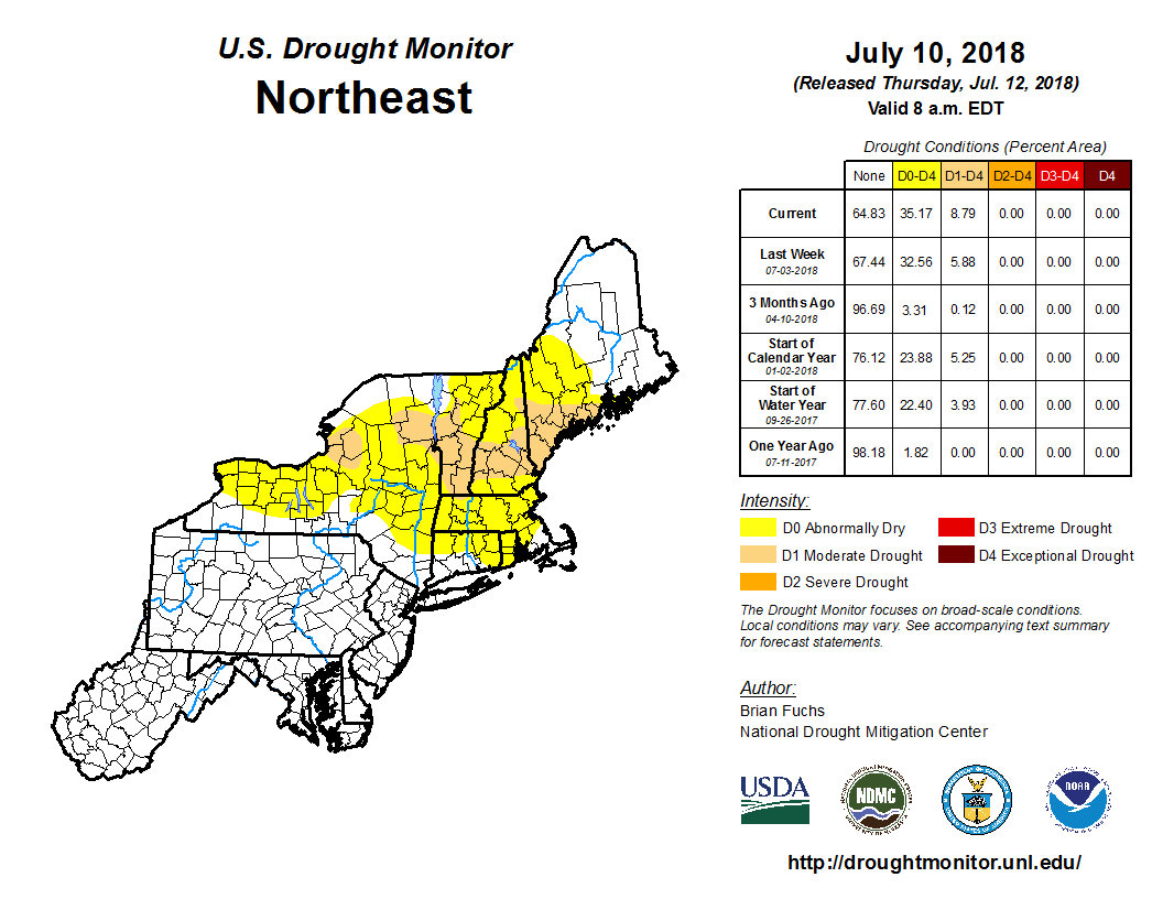
Dry soil conditions are expanding in New England. Most of RI is classified as Abnormally Dry which is one step away from a moderate drought. Part of NH, ME, and VT are experiencing a moderate drought.