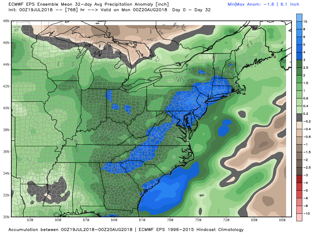
A great stretch of weather gives way to a wetter pattern with high humidity next week. If you’re on vacation, the week is not a total loss, with dry weather likely in RI and SE MA on Tuesday and possibly Wednesday. Other than that, showers and storms are a threat from Sunday through Friday. It will be tropically humid with lows in the 70s and highs generally in the 80s. Florida weather comes to Southeastern New England for a while.
The weather pattern change begins Saturday night with a potent line of showers/storms/wind possible late at night and early Sunday. If you have outdoor plans on Saturday, the weather looks ok, with increasing afternoon clouds and a developing easterly breeze that will probably gust over 20 mph during the afternoon near the coast. Rain likely holds off until at least sunset, and there should not be more than passing showers during the evening. There’s a reasonable chance it will stay dry with temps in the upper 60s to low 70s after dark through midnight.
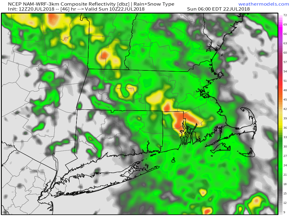
Showers and thunderstorms move in late at night. Any thunderstorms could contain torrential downpours and strong wind gusts over 40 mph. If the wind gusts over 40 mph, there are likely to be some downed limbs and possibly minor power outage issues early Sunday. Scattered showers/storms continue through mid-morning on Sunday, and more showers/storms cannot be ruled out in the afternoon. It will be a humid day with highs in the 70s.
Monday will be unsettled with more showers/storms likely. Expect temperatures in the 70s to low 80s with plenty of clouds. A high pressure ridge centered over the Atlantic Ocean builds west in the midweek. That should push the shower/storm threat out of RI and SE MA temporarily. Expect mainly or all dry days Tuesday and Wednesday. Highs will be 70s coast and 80s inland with some sun and tropical humidity.
It looks like the disturbance to our west returns late Wednesday through the end of the workweek. That brings showers/storms back into the picture for a couple of days on Thursday and Friday. It’s tough to say if there will be a break in the action late Friday into Saturday, but I’m cautiously optimistic for mainly dry weather. There will no break in the humidity, and air-conditioners will be running non-stop to keep it comfortable inside.