Hurricane Dorian blew by New England Friday night with Cape Cod and the islands getting the brunt of the rough weather. 1-3″ of rain fell in eastern Massachusetts, and the wind gusted over 60 mph on Cape Cod and over 50 mph on Nantucket. Showers were few and far between in Connecticut, Rhode Island and interior Southeastern Massachusetts. There were gusty winds near the coast of RI, with a 58 mph gust reported in Charlestown. That may be erroneous given that the peak gusts for Westerly, Newport and Block Island early Saturday morning were 36 mph or less.
The storm is moving away from New England and Saturday afternoon through Sunday look pretty nice in Southern New England. Look for partly sunny skies and highs 65-70 Saturday afternoon. The wind will diminish to less than 10 mph by late in the day. It will be clear and comfortably cool Saturday night. Lows will be 50-55.

Sunday will be a typical early-September day with some sunshine and highs in the low to mid 70s. There will be a westerly breeze around 10 mph. The quiet and mainly dry weather continues into early next week. Expect some clouds early Monday followed by some sun and highs near 70. There is a good chance it will stay dry and seasonable on Tuesday.
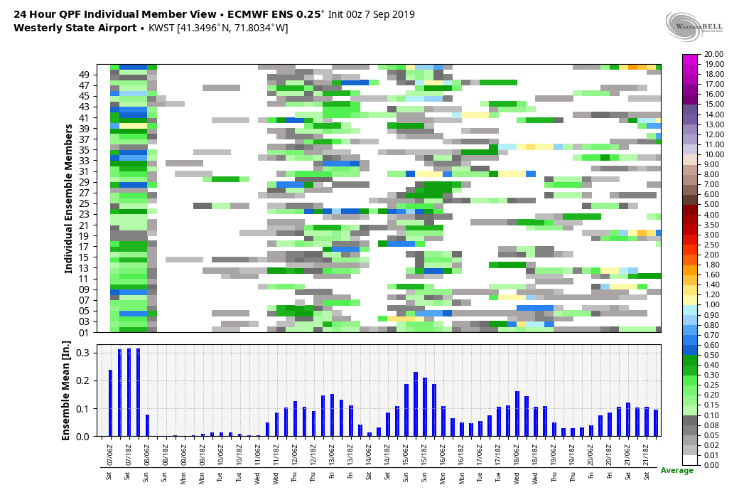
Fast-moving relatively weak disturbances could bring showers in the Wednesday-Thursday time frame. Right now, it does not look like widespread steady rain. It will likely dry out on Friday before another disturbance approaches next weekend. It’s too early to say if that will make it into New England or get diverted by high pressure.
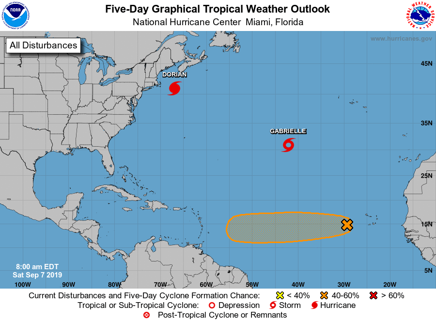
The tropics remain somewhat active at the peak of hurricane season. Dorian and Gabrielle are both in the Atlantic Ocean and not heading for the United States, although Dorian will hit Nova Scotia on Saturday. There is another tropical wave west of the Cape Verde Islands that may develop into the next named system – Humberto.
The EPS model suite members that develop the disturbance into Humberto are split on whether it will move north of the Caribbean into the Atlantic Ocean or stay on the low road and possibly enter the Gulf of Mexico. The bottom-line is there’s a long way to go with that system and the long-range outlook is uncertain. Unless a disturbance develops much closer to the United States, it’s likely that there will be no tropical threats along the U.S. coast for at least the next week.


