


The strong to severe t-storms are moving into Western Connecticut, and will likely bring some wild weather to W CT and W MA this afternoon.
There was nothing developing late this morning in Rhode Island or Southeastern Massachusetts, but anything that does develop this afternoon could quickly become strong to severe. The main threat through this afternoon is for strong winds in any t-storms, with a low risk of tornadoes – greatest in W CT and W MA.
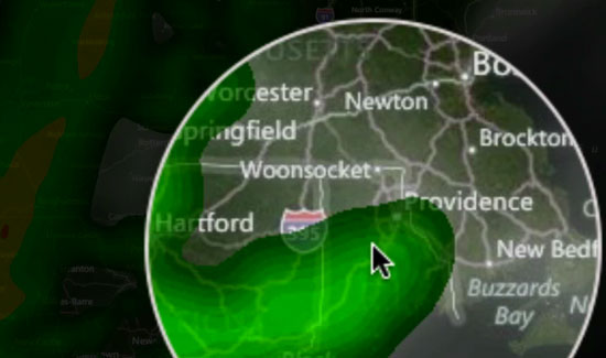
Keep an eye on the Interactive Radar on rightweather.net.
A second, larger area of rain is moving through Pennsylvania and New York this afternoon. That line of showers and t-storms will move through Southern New England from this evening through dawn tomorrow. Those storms should weaken some as they approach RI and SE MA, but some strong winds can’t be ruled out with those storms, either.

http://twitter.com/rightweather
http://facebook.com/rightweather
Download the FREE RightWX app for Android
https://play.google.com/store/apps/details?id=com.mylocaltv.rightwx
Download the FREE RightWX app for iOS (iPhone/iPad)
http://itunes.apple.com/us/app/right-weather-southern-new/id553854414?ls=1&mt=8