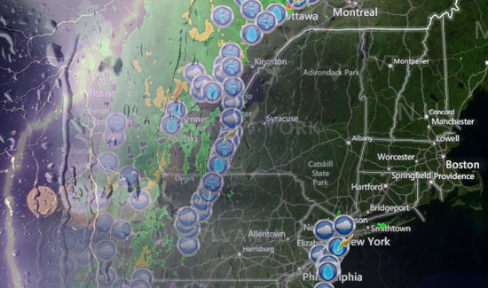
A strong cold front cutting into an unusually warm, muggy airmass for early-September is setting the stage for some potentially strong t-storms in the Northeast today. As of mid-morning, the main line of storms was in Western New York and Western Pennsylvania, with some scattered strong storms developing in the super-charged atmosphere over New Jersey and Southeastern NY – including New York City.
The National Weather Service office in Taunton, MA has issued a special weather statement regarding the potential for strong to severe t-storms later today.
...SEVERE THUNDERSTORMS POSSIBLE THIS AFTERNOON INTO TONIGHT ACROSS
PORTIONS OF SOUTHERN NEW ENGLAND...

THUNDERSTORMS MAY DEVELOP ACROSS SOUTHERN NEW ENGLAND BETWEEN NOON
AND 2 PM...THEN BECOME MORE NUMEROUS DURING THE MID AND LATE
AFTERNOON. SOME STORMS WILL LIKELY CONTAIN STRONG OR DAMAGING
WINDS.  THEY WILL ALSO CONTAIN TORRENTIAL DOWNPOURS WHICH MAY CAUSE
SMALL STREAM AND POOR DRAINAGE FLOODING. THERE IS A MUCH LOWER
CHANCE OF TORNADOES...BUT IT IS A CHANCE WORTH MENTIONING.

ALTHOUGH SEVERE THUNDERSTORMS IN NEW ENGLAND TYPICALLY DIMINISH
WITH SUNSET...THESE THUNDERSTORMS WILL LIKELY CONTINUE INTO EARLY
NIGHT WITH CONTINUED CHANCE OF STRONG OR DAMAGING WINDS AND
TORRENTIAL DOWNPOURS.

THE GREATEST RISK FOR STRONG TO SEVERE THUNDERSTORMS THIS AFTERNOON
WILL BE ACROSS CONNECTICUT...WESTERN MASSACHUSETTS...AND
SOUTHWEST NEW HAMPSHIRE. THIS AREA WILL SPREAD EAST THIS EVENING AND
TONIGHT.
Below are some graphics from the Storm Prediction Center highlighting the threats over the Northeast today.
