


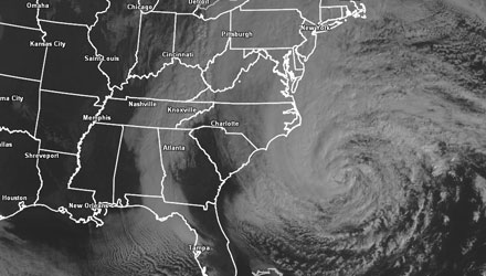
The central pressure in Hurricane Sandy was falling early Sunday, an indication that the storm is holding its own or intensifying. We cannot stress it enough that Sandy is a major threat to life and property in the Mid-Atlantic and New England if precautions are not taken in advance of the storm. The storm is likely to have a bigger impact at the coast of Southern New England than tropical storm Irene last year. Here are some of the key storm impacts and timing.
Hurricane force winds possible in Southern New England
The wind will gradually increase through Monday afternoon. It will be windy near the coast by dawn Monday, with some 40 mph gusts likely. By midday, those gusts will be significantly higher, and sustained winds may reach 40 mph near the coast. The strongest winds are likely between noon and midnight on Monday. STRONG TROPICAL STORM AND HURRICANE FORCE WINDS ARE POSSIBLE. The full detailed wind forecast timeline is available here. http://bit.ly/wind-gusts and is broken down by geographic regions.
Thankfully, a lot of the foliage is off the trees, and most of the rest of it will be stripped by the powerful winds. That, combined with recent tropical storm Irene taking out some diseased and damaged trees, gives a little hope that with similar winds to Irene, the damage would not be as bad. Hurricane Sandy, however, has the potential for stronger winds than Irene because it will be strengthening right up to the point where it reaches the New Jersey coast. It is impossible to predict power outages, and all Southern New Englanders should prepare to lose power during the storm.
Coastal Flooding in Southern New England
As I have stated before, Sandy is the biggest Rhode Island coastal flood threat that I have seen in the past 15 years. The height of the storm will coincide with an astronomically high tide at the RI coast. Moderate to major coastal flooding is likely on the entire Southern New England coast, including Narragansett Bay. The National Weather Service has a great resource for checking on the projected waves, storm surge, and degree of flooding at selected locations throughout Southern New England. http://1.usa.gov/SP08gH
The waves at Pt. Judith are forecasted to be over 20 ft. high, and the amount of beach erosion from Sandy should surpass anything that has occurred in decades along the RI coast. Last night, I wrote a post outlining the particular threat for a well known Rhode Island landmark – the Coast Guard House Restaurant.
The worst flooding will occur during Monday’s late high tides, but some flooding is also possible in surrounding tide cycles, beginning Monday morning through, at least, Tuesday.
Rain forecast for Southern New England
Rain is by far the element of Sandy that will have the lowest impact in Southern New England. Showers are likely on Monday and Tuesday, and by the end of the storm 1-3″ of rain is possible, but that is not enough to cause river/stream flooding. It’s probably a good idea to clear your gutters and any storm drains of any leaves because that amount of rain, while not a lot for a tropical system, is still a decent soaking.
Other parts of the country will pick up a lot more precipitation from Sandy. Amazingly, on the colder side of the storm in the West Virginia mountains they’ll be measuring the snow in feet!

The bottom line on Sandy
Hunker down, it’s going to be a rough ride from Sandy in the entire Northeast. North Carolina to Maine will feel significant impacts from the storm. I don’t think it is a stretch to say Sandy has the potential to be one of the costliest storms to the hit Northeast since the 1950s. A reminder, you won’t be seeing hurricane watches/warnings in the Northeast from this storm. The National Hurricane Center made the decision to not issue that particular type of warning because of Sandy’s transition to a post-tropical storm as it approaches the coast. I let my thoughts be known on that subject on rightweather.net.
I also cut a video late Saturday night on Six Reasons Why Hurricane Sandy Scares Me. This is truly a unique, and maybe once in a lifetime storm.
- Follow all the updates on the Fred Feed Live Blog (Right Weather Pro subscription price has been dropped due to Sandy to $29.99 for a whole year of access)
- Download the FREE RightWX app for your Android or iOS device to stay informed if you lose power
- Interactive Hurricane Tracker
- Hurricane preparation tips
- Sandy impacts
- Protecting your pets during a major storm