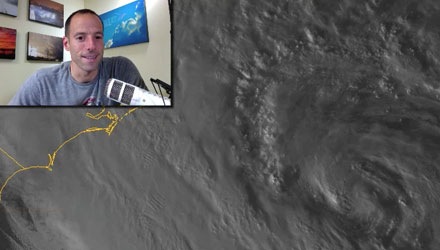
Hurricane Sandy had winds of 75 mph and a very low central pressure of 950 mb as of 8pm Sunday evening. The storm was about 600 miles south of the Rhode Island coast, and moving to the NE. A turn to the north then northwest will occur by early Monday. The storm will head for the New Jersey coast, making landfall Monday evening.
Tropical storm force winds extend 520 miles from the center of the storm. Hurricane force winds extend out 175 miles from the center. Put it this way, the storm is MASSIVE. It is one of the largest Atlantic hurricanes on record, and has the potential to bring a destructive, potentially catastrophic storm surge to the Mid-Atlantic and Southern New England coast.
The weather will continue to deteriorate tonight. The height of the storm will be tomorrow afternoon and early evening. The worst conditions will be near the coast, but all of Southern New England will experience wind gusts powerful enough to down branches, trees, and power lines. The storm surge and coastal flooding tomorrow evening could be the worst that the area has seen in decades.
Check out the video for more on the storm’s impacts in Southern New England.
If you’re reading this on the RightWX app, you will be able to see the video in the video section of the app by 9pm Sunday.
I also cut a video late Saturday night on Six Reasons Why Hurricane Sandy Scares Me. This is truly a unique, and maybe once in a lifetime storm.
- Follow all the updates on the Fred Feed Live Blog (Right Weather Pro subscription price has been dropped due to Sandy to $29.99 for a whole year of access)
- Download the FREE RightWX app for your Android or iOS device to stay informed if you lose power
- Interactive Hurricane Tracker
- Hurricane preparation tips
- Sandy impacts
- Protecting your pets during a major storm
