


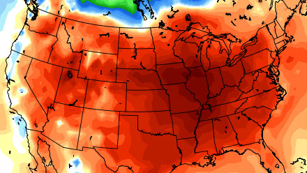
The temperature at TF Green is running more than 4° above normal this December. While very mild, that is actually below the December temperature anomaly for the country as a whole. Through December 16, the contiguous United States had a 3.516° C temperature anomaly – that is an astounding 6.3° F warmer than normal. The map below shows the core of the warm air centered over the Midwest, with some areas averaging about 10° F above normal so far this month.
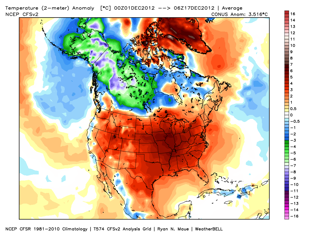
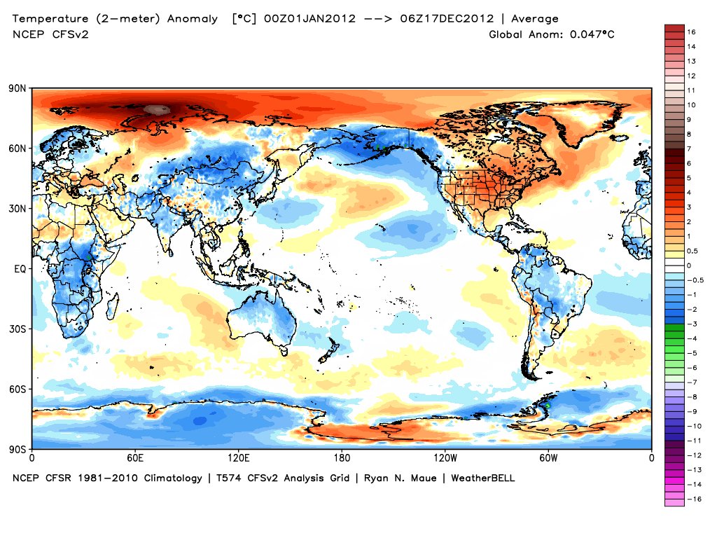
It is definitely worth noting that the United States has been one of the warmest places (relative to normal) on the planet so far this month. In fact, the global average temperature is just about normal for the month. The extremely mild air in the U.S. is being balanced out by some very cold air over Western Canada, Alaska, and Russia. It has also been a chilly December in Europe.

The temperature pattern this month is a rough approximation of the year to date average. The warmest air worldwide has been in the United States in parts of the Arctic this year. The number of record high temperatures has dwarfed the number of record low temperatures. (http://www.ncdc.noaa.gov/extremes/records/)
| Period | Hi Max | Hi Min | Lo Max | Lo Min | |
|---|---|---|---|---|---|
| Yesterday | Dec 16, 2012 | 12 | 141 | 10 | 0 |
| Last 7 Days | Dec 10 – 16, 2012 | 148 | 425 | 26 | 62 |
| Last 30 Days | Nov 17 – Dec 16, 2012 | 2,104 | 2,311 | 103 | 127 |
| Last 365 Days | Dec 18, 2011 – Dec 16, 2012 | 34,464 | 32,426 | 8,898 | 6,333 |
| Month to Date | Dec 1 – 16, 2012 | 1,480 | 1,719 | 40 | 67 |
| Year to Date | Jan 1 – Dec 16, 2012 | 33,712 | 31,717 | 8,833 | 6,301 |
| Last Year to Date | Jan 1 – Dec 16, 2011 | 25,911 | 28,970 | 15,638 | 9,618 |
It will be interesting to see how the weather evolves in the lower 48 this winter. Many computer models are showing a shift from warmer than normal to colder than normal in the next several weeks. The first places to see the drastic change will be in the Upper Midwest where some places may see enough cold air in the next two weeks to completely offset the very warm start to the month. In Southern New England, the month will most likely average warmer than normal, but not to the degree that it has been for the past two weeks. If the storm track doesn’t change, it will go into the books as one of the least snowiest Decembers on record in Providence, Worcester, Boston, and Hartford.