The computer models continue to advertise a more significant snow event for Southern New England Saturday afternoon and night. We’ve been telling you all week (longer if you’re a Pro member) that it was going to be a close call with a Nor’easter this weekend, and now it looks like the storm will be closer to a Nor’easter than a non event.
Snow will break out around midday and quickly become steady during the afternoon. There is some concern for mixed precip. or rain at the immediate coast at the start of the storm. The precip. will likely start as rain on the Cape/Islands, but a change to snow is likely Saturday evening.
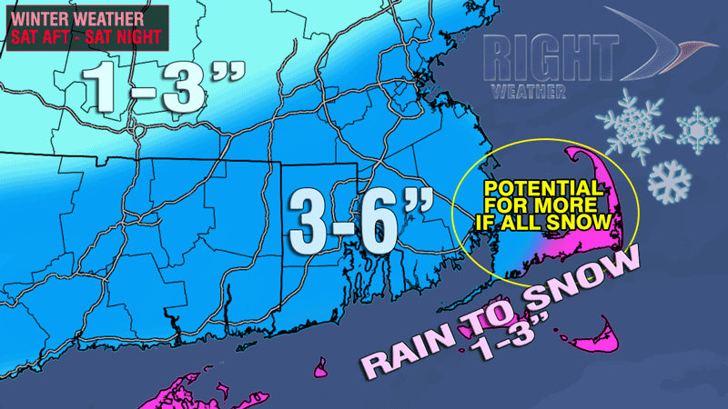
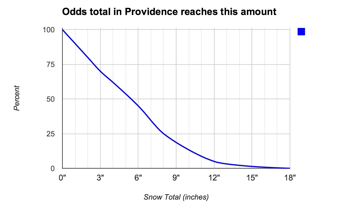
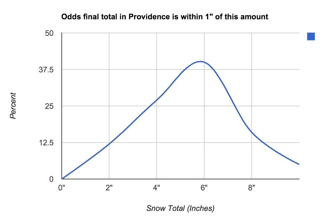
The graphics below include the traditional snow forecast map, and some probability graphics displaying the odds of reaching a certain amount in the Providence area, and the most likely final snow amounts in the Providence area. Since this is a storm that will bring a similar amount of snow to the RI and most of SE MA, these odds are similar for places like Newport, New Bedford, Taunton, and even Boston.
In the first graphic, notice how likely it is that the Providence area will receive at least 3-4″ of snow. The odds diminish gradually, indicating that there is some decent potential for a 6-9″ snow event if the storm is a bit stronger than forecast.
The next graphic shows how unlikely it is for a less than 2″ snowfall in the Providence area. The odds are also relatively low (20-25%) that the final total is in the 2-4″ range. The largest part of the hump is between 4-7″, a moderate snowstorm for the area. There is about a 15% chance of a 7-9″ event.
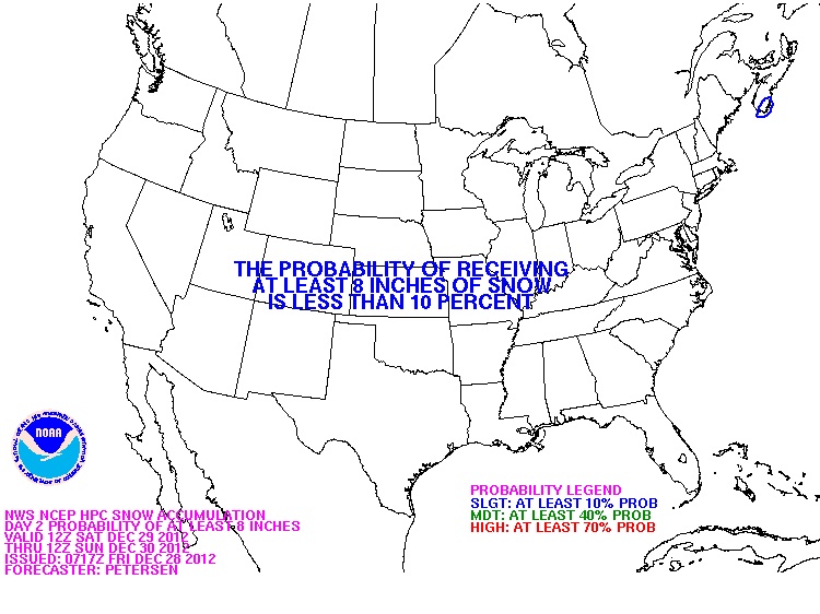
This graphic from the HPC late last night indictates little chance of an 8″ event in SNE. My guess is this will be updated this afternoon to include at least a 10-40% chance in RI and SE MA.
This is the traditional snow map. The battle between rain and snow on the Cape will be interesting, especially near Falmouth. Those areas will see the most precipitation, but it is uncertain how much will be rain and how much will be snow. After reviewing this morning’s data, my only inclination is to raise the totals by 1″ in most areas. I will leave it as is for now, with room for adjustment later today or early-Saturday.