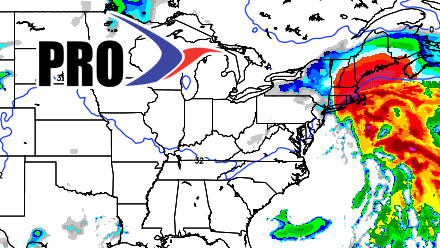
A reminder that this post is basically “inside baseball” giving you a look at some of the raw data coming from the computer models that we use to help us forecast the weather. Nothing in this post represents a specific Right Weather forecast, although a lot of the model data shown here constitutes a major part of the forecast process. With that, lets get a look at the Wednesday morning computer model runs.
A few things:
12Z run = 7 am EST initialization time
00Z run = 7 pm EST initialization time
QPF = Quantitative Precipitation Forecast (how much liquid precipitation falls – must convert for snow totals)
Here is the new accumulation map that will be issued on the free site this afternoon
12Z ECMWF
This is the one we wait for. The ECMWF was right on Isaac, right on Sandy, and will be right on this storm if the big Nor’easter materializes. It has a great track record in the Super Bowls, if you know what I mean. See the Tweet below for the difference between free Right Weather and Right Weather Pro. The non-members get cryptic Tweets with a sit ‘n spin, the members get to read about the storm stalling east of Nantucket and wailing on Southern New England through midday Saturday.
The storm starts rather slowly on Friday, with the precipitation arriving in Providence around midday, and then getting steadier by sunset. The brunt of the storm is from 8pm Friday to about noon on Saturday. The storm produces heavy snow, strong wind, coastal flooding (due to long-duration) in Southern New England. Total QPF in Providence is about 2.9″ – that would yield about two feet of snow based on some mixing at the start of the storm. Very impressive!
How's this for a cryptic Tweet. Here's the 12Z ECMWF in a nutshell. http://t.co/x0kC7RaY
— Fred Campagna (@FredCampagna) February 6, 2013
12Z Canadian
I’m running out of adjectives for these computer model runs today. The 12Z Canadian is a historic storm for Southern New England. It would be top-3 for Boston and Providence, in my opinion. It has it all snow, wind, long-duration. The storm is still cranking at 7am Saturday, and slowly moves away from the coast during the day. There is an issue with mixed precip. or rain from the coast to Providence Friday afternoon. Most models are showing that, then a change to heavy, wind-driven snow Friday night through Saturday morning. Even with the rain hiccup, the Providence area would get 1-2 feet based on the 12Z Canadian.
12Z GFS
The 12Z GFS looks tame in comparison to the 12Z NAM, but anything would. It is still a huge snowstorm for Southern New England, with some very impressive totals. It is also trending toward a slower, long-duration event, though not quite to the extent of the NAM. It has roughly 2-2.25″ of QPF in Providence, which translates to around 20″ of snow – give or take a few inches due to the potential for some mixing in the Providence area. The same very strong wind potential exists for the RI coast, Buzzards Bay, E MA coast, Cape Cod, and the islands. Peak gusts could be over 75 mph on the Cape/Islands if the GFS verifies.
12Z NAM
The NAM is at a press conference deflecting questions about whether it used deer antler spray prior to processing the 12Z run. Simply put, this is the most extreme snow forecast from a computer model that I’ve seen in 15 years of forecasting. The NAM starts with some snow and mixed precipitation Friday morning through Friday afternoon from the coast to Providence. Once the sun sets, the storm really starts cranking to the south of SNE, and IT IS ON from there on out. It actually has a long-duration storm that lasts through Saturday afternoon. The snow totals are off the charts, and approaching ludicrous levels. It forecasts a widespread area of 25-55″ of snow for RI, SE MA, and Coastal ME. Even if you halve those amounts, you’re still talking about a major league storm. The NAM also produces extreme winds in E MA. Sustained winds of 65 mph on Cape Cod, with gusts over 80 mph early Saturday.
Although it’s an extreme example, the big takeaway is that this high-resolution model sees a major, potentially historic, winter storm for New England Friday into Saturday. The NAM has a full-fledged blizzard with several hours of heavy snow and 35+ mph winds in RI and all of SE MA. It may be on to something with the longer duration. Last night’s Euro run hinted at that, too.
The other models will be included as they arrive on Wednesday.
