

A storm will impact Southern New England for the third straight weekend. The last two storms, both blizzards, have been predominantly snow for all of Southeastern New England. This time around, there are many questions surrounding the track of the system, and, ultimately, whether it brings snow, rain, or a mix to RI, MA, and CT.
Feel free to ask any questions in the comment section at the end of the blog. Click to enlarge all images.
A few things:
12Z run = 7 am EST initialization time
00Z run = 7 pm EST initialization time
QPF = Quantitative Precipitation Forecast (how much liquid precipitation falls – must convert for snow totals)
Most maps courtesy weatherbell.com
At this point, the odds favor both rain and snow in Southern New England, with the best chance of rain near the coast. The storm that is heading across the country in a very active weather pattern is likely to bring snow from the Southwest through the Plains to the Mid-Atlantic and New England. This will be one of several storms in the next 10-14 days to have a significant impact in the Eastern United States. Let’s find out what the latest computer model runs are predicting.

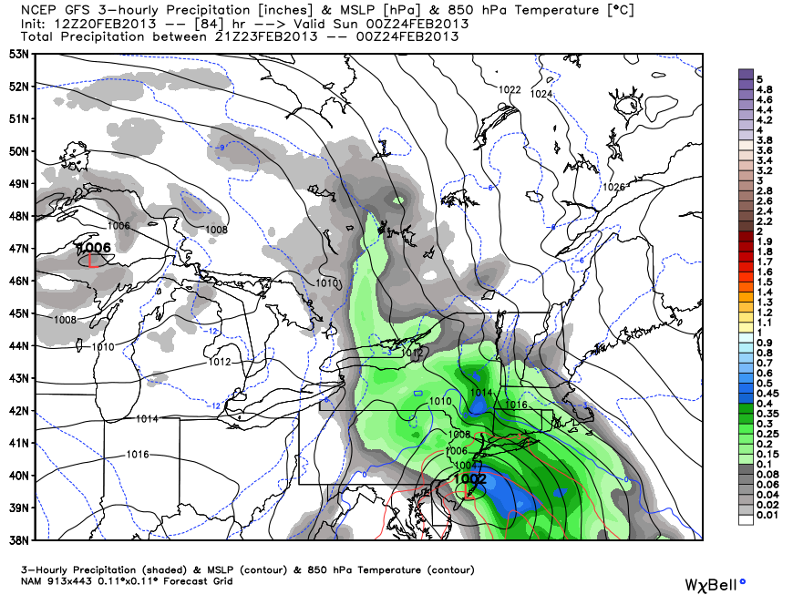
NAM (North American Model)
The NAM only goes out 84 hours, so we only catch a glimpse of the storm track and impact in Southern New England. Based on the 12Z 84 hour panel (7pm Sat) it looks like the storm will take a track close enough to the coast to go snow-rain-snow or snow-rain from the coast to the I-95 corridor.
The storm is over Atlantic City, NJ, with an easterly wind in Southern New England at 7pm Saturday. That is not a very favorable storm position or wind direction for the precipitation to remain as snow. The initial burst (front end thump) would probably be snow, especially inland, and a few inches could accumulate before the change to mix/rain from the coast to inland locations Saturday night. Of course, since the NAM ends at 7pm Saturday, it’s hard to know exactly where the storm is tracking, but, it looks like it’s heading too close to the coast for all snow.
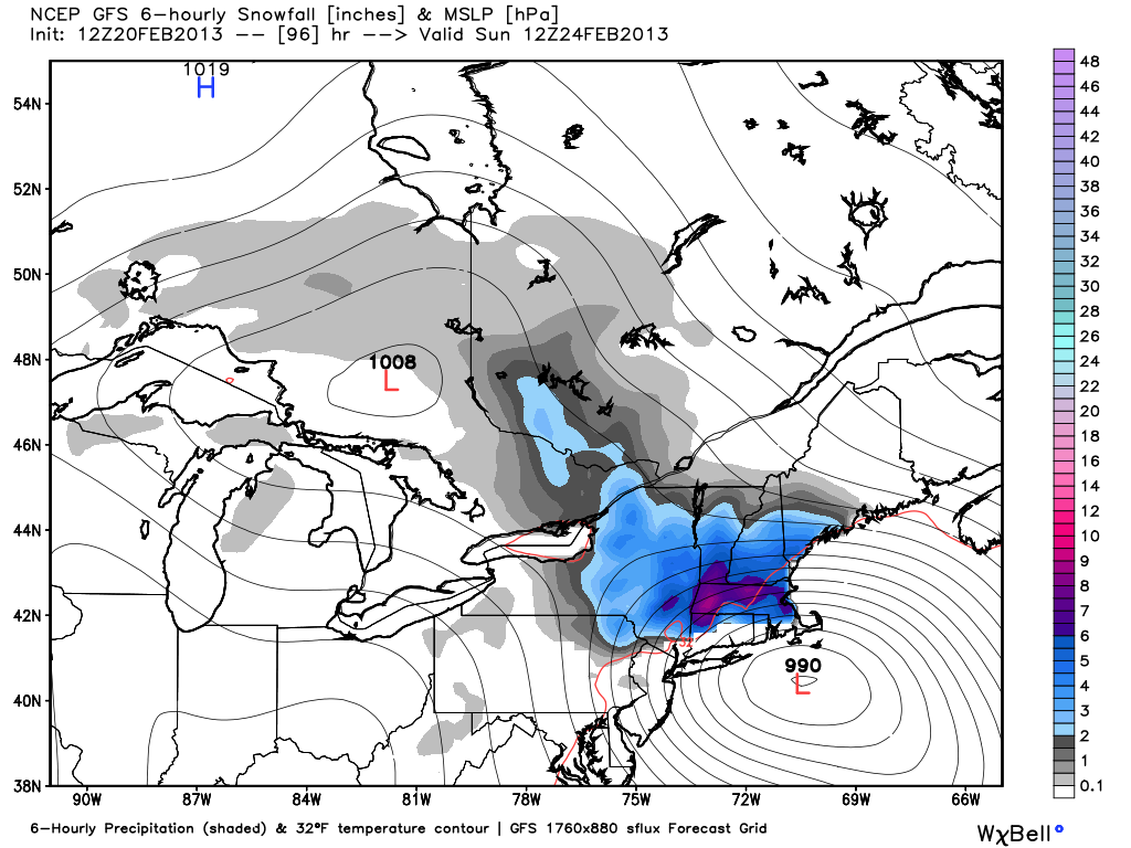
GFS (Global Forecast System)
The 12Z GFS has a very robust, moisture-laden storm that brings significant snow to interior New England Saturday night into Sunday. The storm track is close enough that the coast to I-95 goes from snow to rain to snow, with minor accumulations at the beginning and end of the storm. Farther inland, in Worcester for example, the snow really piles up. The QPF is about 1.5″ in Providence, but the bulk of it falls as rain with the temperature in the mid 30s. Worcester, however, remains all snow, and a foot is on the ground by mid-morning Sunday. At this point, even though the model favors rain near the coast for the bulk of the storm, it’s too early to say that this will not be a big snowmaker in Providence and Boston. In fact, Boston is even closer to the rain/snow line. Based on the 12Z run, Boston goes from snow to mix to snow, with about four messy inches of snow/sleet accumulating.
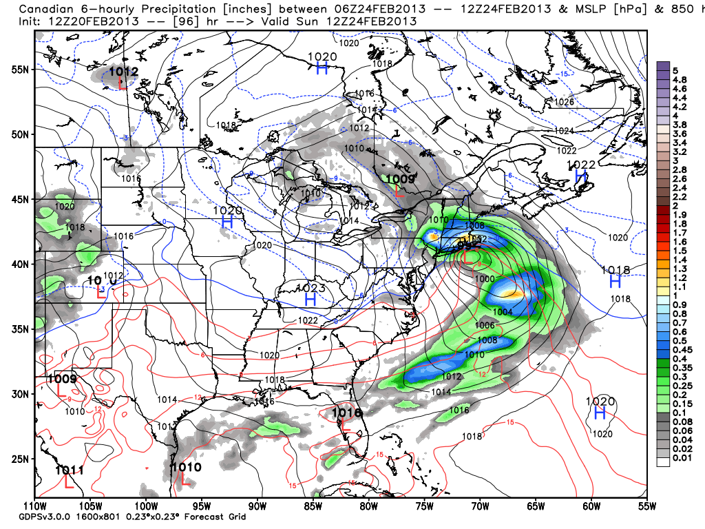
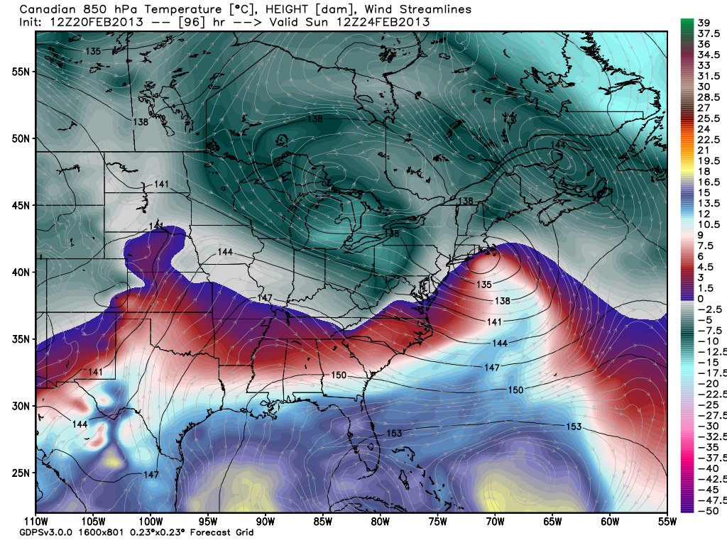
(GEM)Canadian
Last week, the Canadian consistently had the weekend storm too close to the coast during the midweek runs. This week, it is also tracking the storm fairly close to the coast, and, as a result, rain is the predominant precipitation type for Southeastern New England from the coast to I-95. It’s a different story inland, with heavy snow falling in N RI, interior MA, and interior CT. It’s the same setup as most models, and that’s a storm that tracks close enough to throw the wind around to the east and bring in air that’s just mild enough to change snow to mix/rain within 20-30 miles of the coast. The position of the high pressure center to the east-northeast of New England is not ideal because it fails to lock in the colder air by forcing the wind to the northeast instead of the east.
SREF (Short Range Ensemble Forecast)
The SREF is just getting a whiff of the storm because the run only goes out to 7pm Saturday. Most members bring some snow before any change to rain. This type of ensemble forecasting, where the mean (average) is looked at is becoming increasing popular in the meteorological community, and we’ll be looking closely at it in the coming days.
ECMWF (European)
The 12z Euro brings mainly rain to Southeastern New England, with the storm tracking closer than most other models. We’re not allowed to show ECMWF maps on the site, but we can tell you that the storm tracks just south of Long Island then over Nantucket – much too close for mainly snow in RI and SE MA given the position of the high to the east-northeast and an easterly wind direction. If the 12Z Euro verifies, the lion’s share of the snow will be north of the MA Pike. There would be a brief front-end thump of snow in RI and SE MA, but the bulk of the storm would be chilly rain. The Euro has about 1.5″ of QPF in the Providence area, with about 2″ farther inland into Central MA. That indicates this could be a major snow event for the areas that stay all snow in N MA and S NH, VT, and ME.
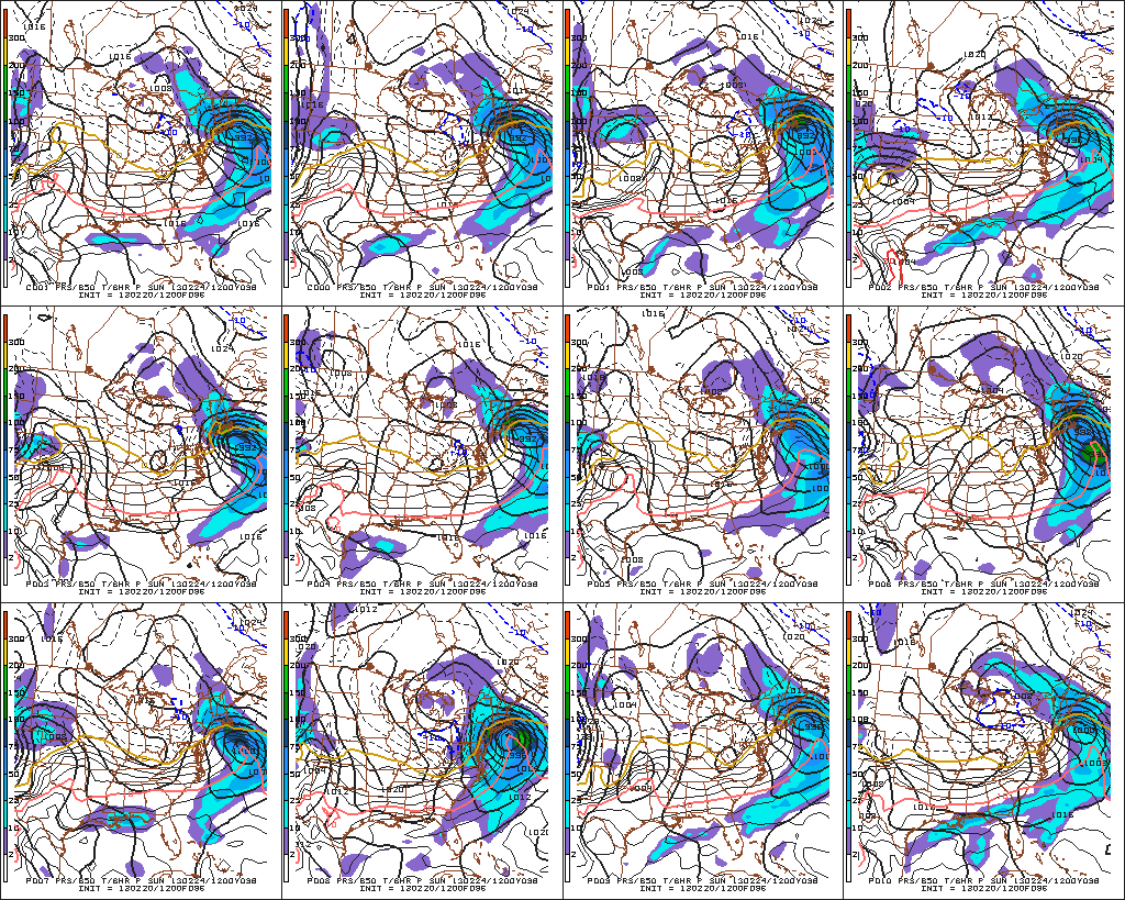
GEFS (Global Ensemble Forecast System)
All the GEFS members have a storm impacting Southern New England. Overall, there is excellent agreement on the timing and track of the system, with most bringing a snow-rain scenario to Southeastern New England.
The bottom-line
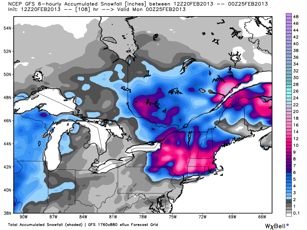
The trend in the 12z models is for the storm to track close enough to take the possibility of a major snowstorm off the table for coastal Southeastern New England. Farther inland, from NW RI, N CT and interior MA to Northern New England, there remains a threat of heavy snow. Since we’re just analyzing run to run trends, I think it’s important to not waver too much on the general idea of the forecast: A storm will bring moderate to heavy precipitation to Southern New England this weekend. It will likely begin Saturday afternoon and peak Saturday night before winding down on Sunday. Right now, the track favors snow to rain, especially near the coast, but it is too early to say if the current projected track will hold as the jet stream energy is just now reaching the Southwestern United States.