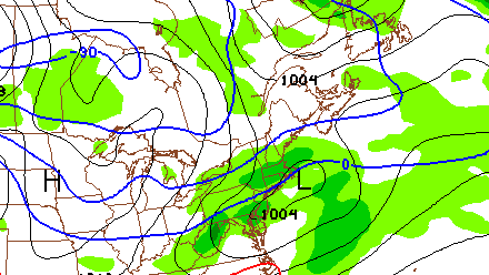
The weather in Southern New England bounced back quite nicely after the moderate to heavy rain that fell Tuesday evening. Wednesday featured lots of sunshine, and highs in the low 50s. Unfortunately, after Wednesday, the theme for the next week is for colder than normal weather in Southern New England.
Thursday and Friday both look dry, but cool, with highs in the low 40s and a gusty northwesterly breeze. The low temperature Friday morning will be in the low to mid 20s. Clouds and showers are in the forecast for Saturday as a fast-moving Alberta Clipper moves through Southern New England. There is the chance of snow showers inland with chilly rain near the coast. There will most likely not be heavy precipitation from the weak system, but the conditions could be dreary/raw for the St. Patrick’s Day parade in Newport, RI. Highs will be in the 30s to low 40s on Saturday.
Drier weather returns Sunday, but do not expect a warm-up. The high temperature will struggle to reach 40 degrees with partly cloudy skies. The morning low temperature will be in the 20s. Two more weather systems may impact Southern New England early next week. First, another fast-moving Clipper could spread light snow over the area Sunday night. It will be followed by another, stronger system on Tuesday. Right now, it looks like that may be more rain than snow in RI and SE MA, but the track of the storm is uncertain. Spring officially arrives on Wednesday, but it definitely will not be feeling like it, at least in Southern New England.
