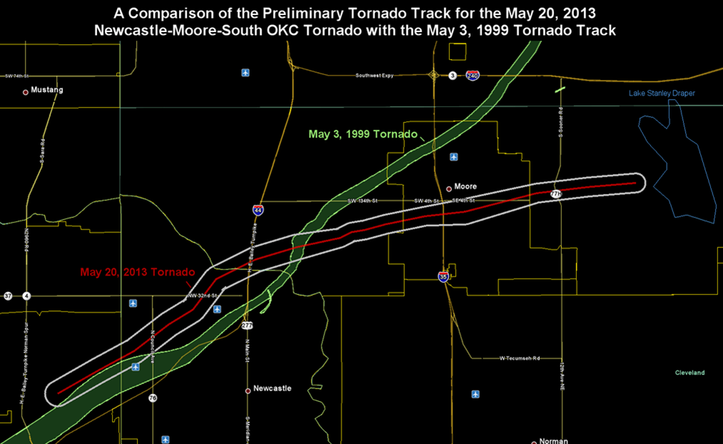
One of the most destructive tornadoes in United States’ history ripped through Moore, Oklahoma, a suburb of Oklahoma City, on Monday, May 20, 2013. Dozens were killed by the tornado which was estimated to be 2 miles wide with winds of up to 200 mph. This is not the first time Moore, Oklahoma has been hit by a devastating tornado. On May 3, 1999 and EF-5 tornado moved through the Oklahoma City metropolitan area on a similar path killing 42 people. Below are some pictures and video from the tornado.
Time-lapse footage
http://youtu.be/AXz1_F88n14
Chaser footage
Chaser footage – good perspective on the size of the tornado
Raw footage of the tornado (some foul language)
Footage of the tornado forming
Three videos from the same chaser show the mammoth tornado
Raw: Witness Describes Scene After Okla. Tornado
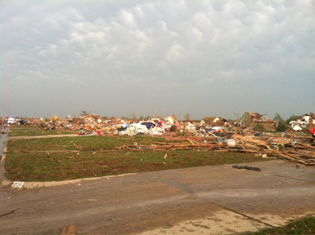
Raw video of the damage following the Moore, OK tornado
Oklahoma tornado survivor finds dog buried alive under rubble
http://youtu.be/ZBUY2dQuK94
One man’s reaction to coming out of his storm cellar following the Moore, OK tornado
Eerily quiet with birds chirping after the tornado
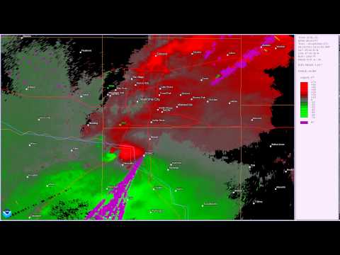
Doppler radar loop of the tornado
Smartphone footage in high-definition
Recap video of the 1999 Moore Tornado
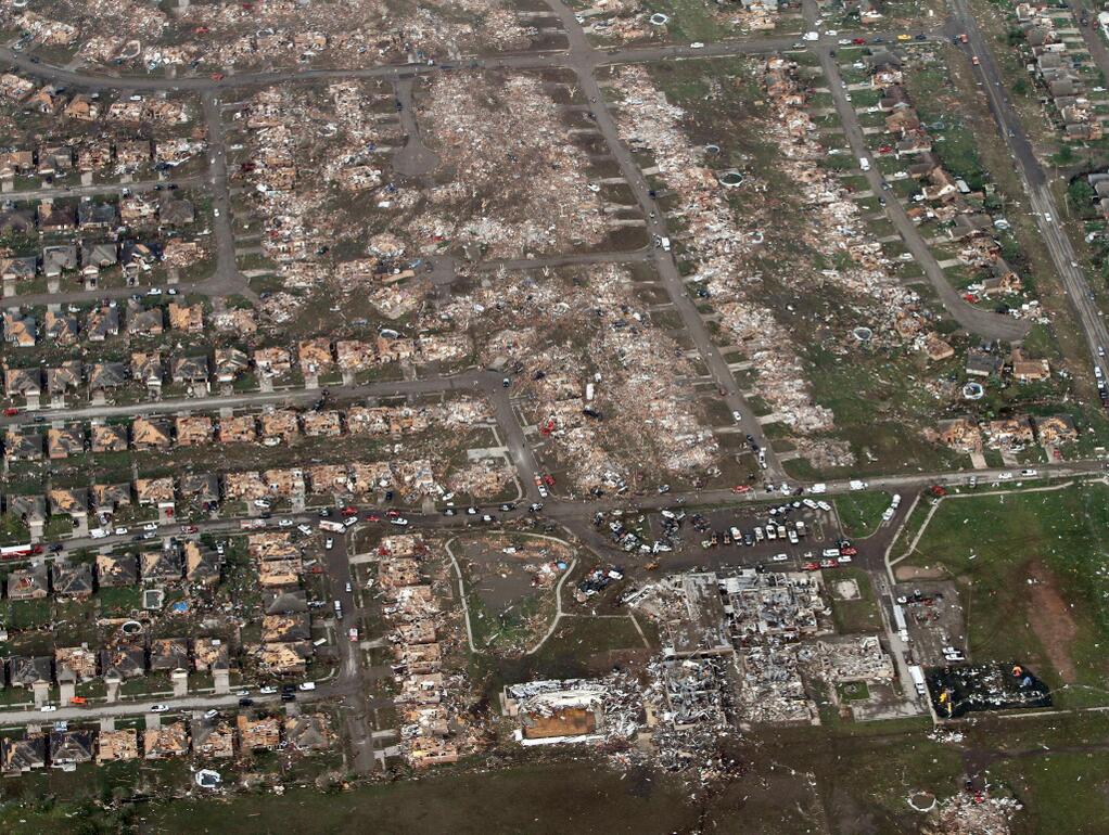
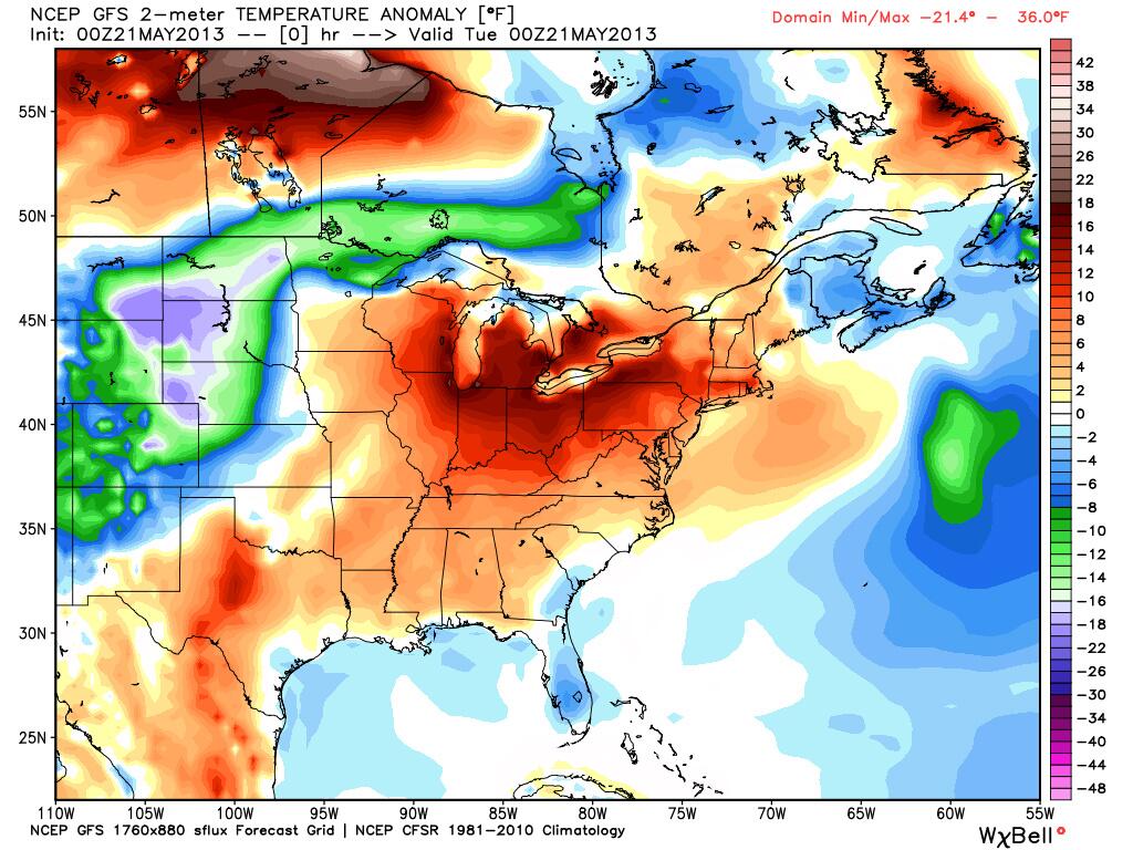
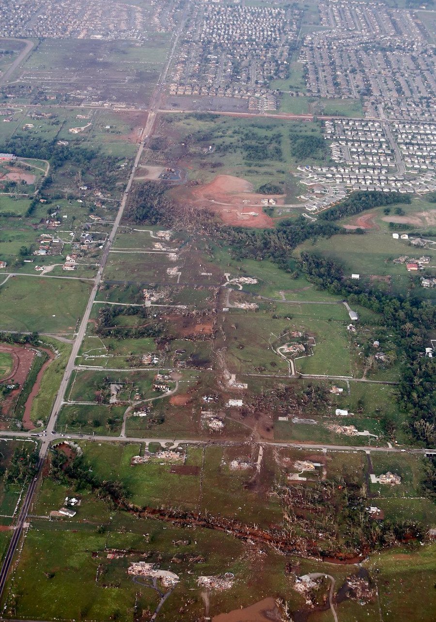
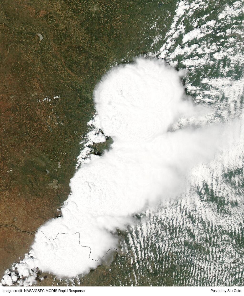
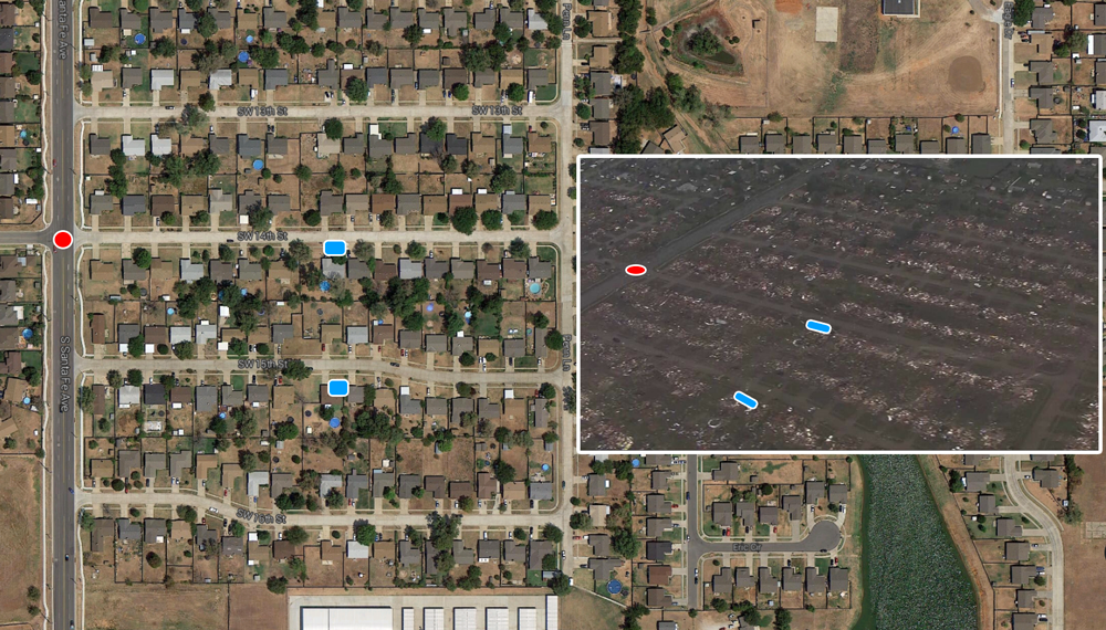
Aerial photo of the damage to Moore, OK following the tornado on May 20, 2013An unseasonably cool airmass colliding with warm, muggy weather coming out of the Gulf of Mexico set the stage for large thunderstorms and tornadoesAerial photo shows the path of the tornado on May 20, 2013 through Moore, OKNewspaper front page on May 21, 2013 – the day after the tornado
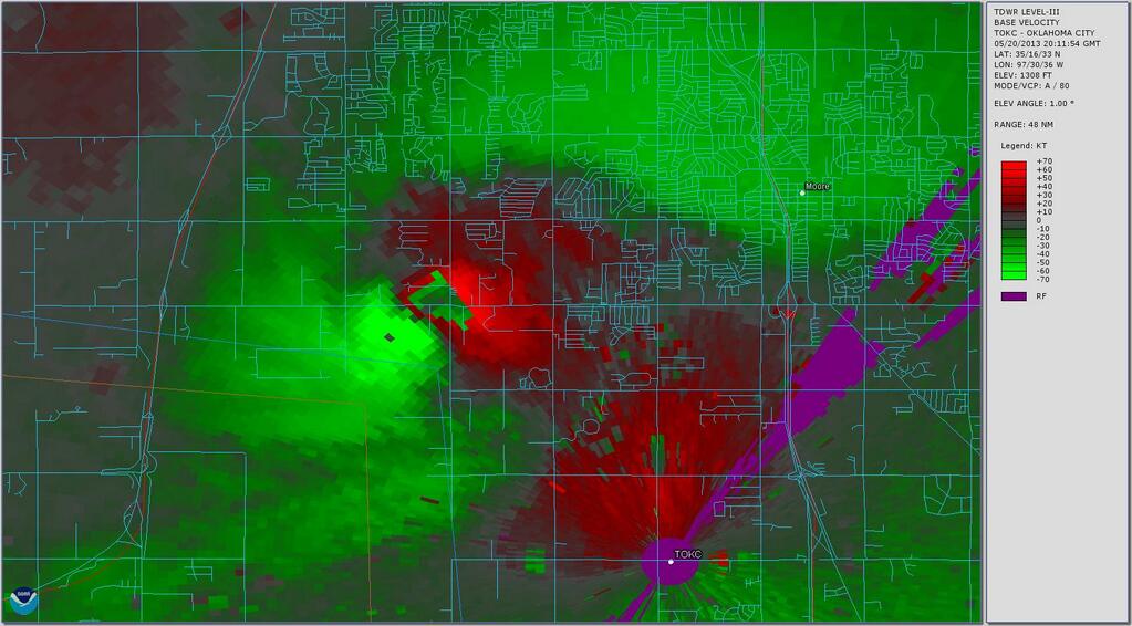
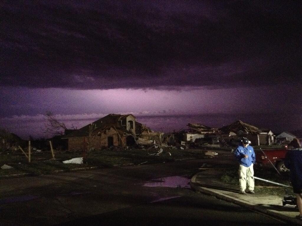
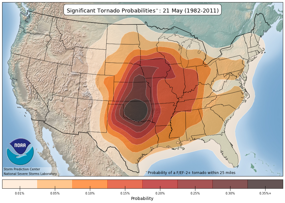
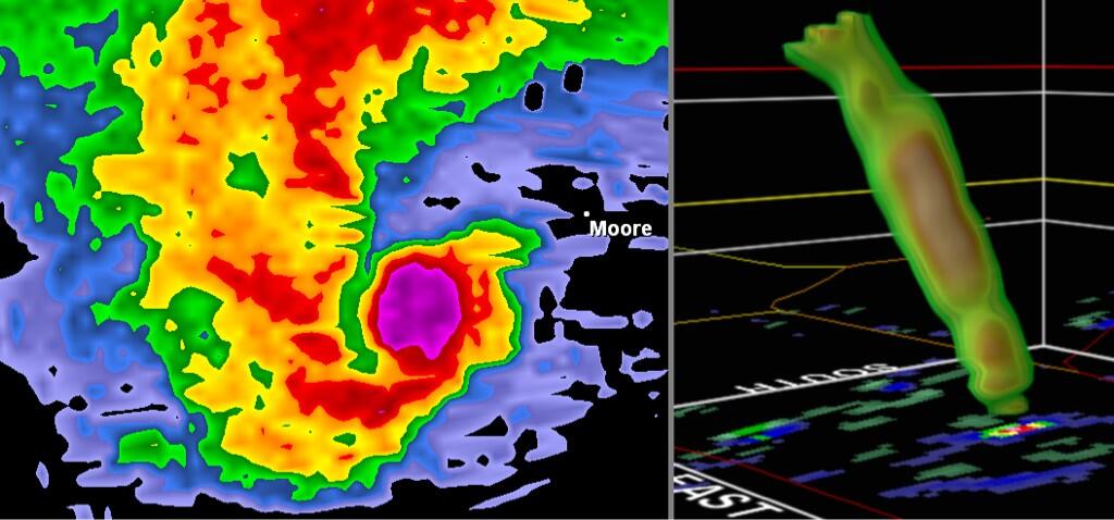
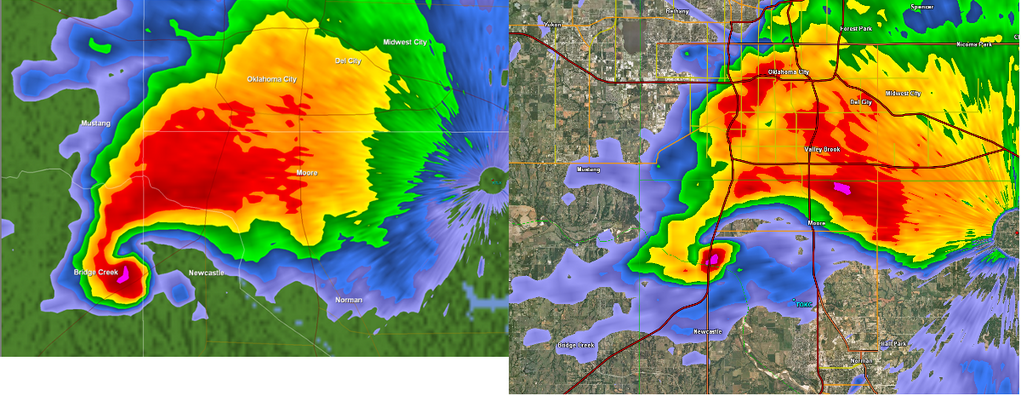
Newspaper front page on May 21, 2013 – the day after the tornadoNewspaper front page on May 21, 2013 – the day after the tornadoRadar wind estimates of the tornado when it was southwest of Moore, OKLightning lights up the sky over a Weather Channel live broadcast the night after the tornadoAn American flag is raised from the rubble as the recovery effort continues the first night after the tornado in Moore, OKGraphic showing the similar paths taken by the May 3, 1999 and May 20, 2013 tornadoes near Oklahoma City.Moore, OK is near the bulls-eye on this map depicting the historical probability of a significant tornado on May 20.Damage at the Moore Medical CenterHi-res satellite image of the thunderstorm cluster that produced the Moore, OK tornado. The tornado was in the top (north) of the cluster.Left – debris ball associated with Moore, OK tornado Right – 3D radar image of the tornadoRadar image of 1999 Moore, OK tornado on left and May 20, 2013 tornado on right Before and after pictures of Moore, OK