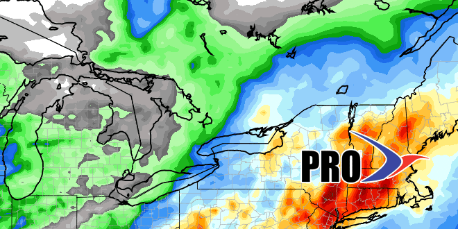
The long range computer models have hinted at the potential for Gulf of Mexico storm development and late-week or weekend rain in Southern New England for a while. In case you missed it, we covered the threat in the past few Long Range Forecasts. As the forecast comes into focus, the odds of a big time soaking rain along the Eastern Seaboard are increasing. The timing of the rain is critical with all the outdoor events planned at this time of the year. The latest computer model trends have the Gulf of Mexico storm, which may become Tropical Storm Andrea, moving quickly north and out of the picture by mid-morning on Saturday.
The potential for flooding rain looks like the biggest impact from the storm. While it may get a bit windy near the coast, unless there is unforeseen intensification, the wind will not be strong enough to cause damage.
Here are some details on what the models are showing. Click on the images for larger versions. Graphics courtesy weatherbell.com.
