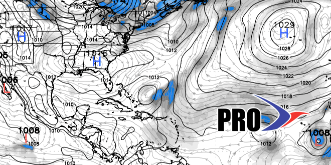
After a very soggy start to the month, it looks like the weather will be considerably drier in the next couple of weeks. The prevailing pattern has large areas of high pressure moving from the Central Canada to the Northeastern United States every few days. The next cold fronts to pass Southern New England with the chance of scattered showers are on Sunday and in the middle to end of next week. The Sunday front looks like it will be moisture-starved and probably not producing steady rain for hours on end. It may be a completely dry frontal passage for some of Southern New England.
After a cool, dry start next week, the next front arrives in the Thursday-Friday timeframe. That front should have more available moisture, and it may grab some remnant moisture from short-lived Gabrielle on its way by. It also looks like a slow-mover, and could bring rain into the start of next weekend. A round of showers and thunderstorms can be expected late next week. There will be another area of high pressure that moves in behind the front bringing pleasant weather back by the end of next weekend, and possibly a little sooner than that.
Dry weather will last from late next weekend into the following week before another front arrives from the west. If the tropics get active, the door could be open to an impact in the Southeastern United States around that time. It’s something to keep an eye on.
Overall, the weather does not look particularly warm in the next couple of weeks. Each time a front passes there will be a cool, dry shot of air that moves into SNE. There will be warmer weather ahead of the cold fronts, but nothing too warm or humid is expected. The temperature should average near to below normal through mid-September.
