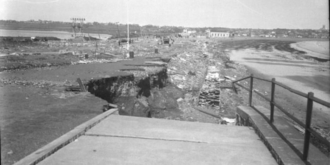
September, 21, 2013 marks the 75th anniversary of the Hurricane of 1938, one of the most destructive storms to hit the United States in the past 100 years. The hurricane roared up the Eastern Seaboard and slammed into Long Island without warning. The catastrophic hurricane killed more than 600 people and caused more than $300 million (1938 dollars) in damage.
Many weather websites and media outlets have published commemorative articles and videos about the storm. Here are some great resources for learning more about the Great Hurricane of 1938:
- National Weather Service Boston Office (complete wrap-up including meteorology and photos)
- National Weather Service New York Office (complete wrap-up including meteorology and photos)
- WCVB (video)
- WBZ-TV (video)
- WFXT (video)
- CT Post – Remembering the Great Hurricane of 1938 (slideshow)
- NBC Connecticut (photos and videos)
- East Bay RI Newspapers – PDF of historical book
- Providence Journal
- Boston.com Photo Gallery
- New Haven Independent – In one suck the lollipop was gone
- Washington Post Capital Weather Gang
- The Martha’s Vineyard Times – The Historical Perspective: Remembering the 1938 Hurricane
- Cape Cod Times – Recalling the Great Hurricane of 1938
- WJAR – Hurricane of ’38: 75 years later
- WLNE – Remembering the Hurricane of ’38 (video)
- News 12 Long Island – Survivors’ stories
- RI Secretary of State (photos)
The storm was originally expected to strike Florida, and when it turned north before reaching the Sunshine State, forecasters believed that it was going to do what most hurricanes that threaten the Atlantic Coast do – turn northeast and head out to sea. Instead, the storm moved due north and raced across Long Island into Southern New England.
The storm made landfall in the mid to late afternoon on Long Island as a category three with sustained winds of 115 mph. The peak wind gust reported in Southern New England at the Blue Hill Observatory was an astounding 186 mph – to this date the highest hurricane wind gust ever reported in the United States. Blue Hill recorded sustained winds of 121 mph.
The massive storm surge of 14-20 ft. was made worse by the astronomical high tide close to the autumnal equinox. It is reported that 100 Rhode Islanders died as a direct result of the storm surge hitting the south coast. Providence, New Bedford and Falmouth were all under 8-10 ft. of water due to the surge.
There have been notable hurricanes to hit Southern New England since 1938, but none can compare to the Long Island Express.
The following pictures were sent to Right Weather Chief Meteorologist Fred Campagna by a television viewer several years ago. They are primarily from the Riverside area of Rhode Island.
