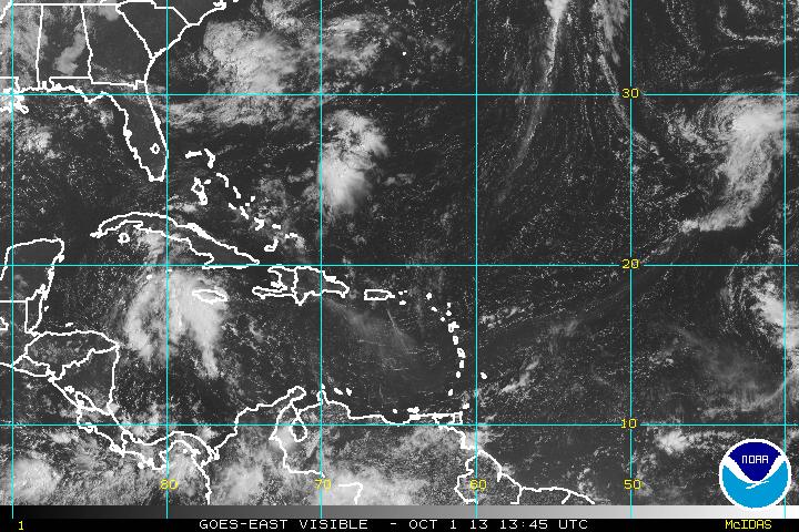
The National Hurricane Center is monitoring a disturbance in the Western Caribbean that will likely enter the Gulf of Mexico and may become a tropical cyclone. The disturbance known as Invest 97 was east of Honduras in the Western Caribbean Sea Tuesday morning. It is moving to the northwest and is likely to cross the eastern Yucatán Peninsula in the next couple of days. The system will emerge into the Gulf of Mexico and begin a gradual turn o the northeast as it interacts with a jet stream disturbance moving through the Central United States late in the week.
The system will likely bring rain to the Gulf Coast of the U.S. and may eventually move through the Eastern U.S. regardless of whether it develops into a tropical cyclone. The National Hurricane Center gives the disturbance a 30% chance of becoming a tropical cyclone in the next 48 hours, and a 50% chance of development in the next five days.
Computer model forecasts for Invest 97
TROPICAL WEATHER OUTLOOK
NWS NATIONAL HURRICANE CENTER MIAMI FL
800 AM EDT TUE OCT 1 2013

FOR THE NORTH ATLANTIC...CARIBBEAN SEA AND THE GULF OF MEXICO...

SHOWER AND THUNDERSTORM ACTIVITY ASSOCIATED WITH AN AREA OF LOW
PRESSURE OVER THE WESTERN CARIBBEAN SEA HAS CHANGED LITTLE IN
ORGANIZATION OVER THE PAST FEW HOURS.  SOME DEVELOPMENT OF THIS LOW
IS POSSIBLE DURING THE NEXT COUPLE OF DAYS WHILE IT MOVES
NORTHWESTWARD AT AROUND 10 MPH...AND THIS SYSTEM HAS A MEDIUM
CHANCE...30 PERCENT...OF BECOMING A TROPICAL CYCLONE DURING THE
NEXT 48 HOURS.  UPPER-LEVEL WINDS ARE EXPECTED TO BE MARGINALLY
CONDUCIVE FOR DEVELOPMENT WHEN THE DISTURBANCE MOVES OVER THE
SOUTHERN GULF OF MEXICO LATER THIS WEEK...AND THE SYSTEM HAS A
MEDIUM CHANCE...50 PERCENT...OF BECOMING A TROPICAL CYCLONE DURING
THE NEXT 5 DAYS.  LOCALLY HEAVY RAINS COULD AFFECT PORTIONS OF
JAMAICA...CUBA...AND THE CAYMAN ISLANDS DURING THE NEXT DAY OR TWO.
