

The departing snowstorm will leave a thick blanket of fluffy snow in Southern New England and a wealth of frigid air in its wake on Wednesday. Snow should end by 10 am in RI and by noon in Southeastern Massachusetts on Wednesday. Check the live blog for storm updates. It will become partly sunny on Wednesday afternoon, but the high temperature will only be in the teens to low 20s, and wind chills will be in the single digits thanks to a 15-25 mph northwesterly breeze.
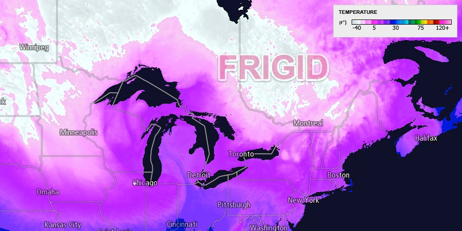
It will be mainly clear and frigid Wednesday night. Low temperatures will range from about -5° inland to 5° near the coast. There will be a 5-10 mph westerly wind that drops wind chills to -5 to -15°. It will not warm up much on Thursday, even with a decent dose of sunshine. Highs will struggle to reach the low 20s. The breeze will make it feel colder.
The temperature will drop to near zero again Thursday night, and Friday may be the coldest day of the workweek with highs in the mid to upper teens. It will be partly cloudy. An Arctic cold front will approach Southern New England early in the weekend. As a result, the wind will shift to the southwest, and the temperature will warm into the upper 20s to low 30s by early Saturday. Snow showers, and possibly snow squalls, are in the forecast for Saturday as the front plows through. Highs will be in the 30s. Some snow accumulation is possible, especially inland.
Sunday looks like a dry and very cold day, with highs only near 20°. It will be windy, too. Another storm system may threaten Southern New England with snow early next week as the active winter weather pattern continues.