

Friday was the third straight day with a high temperature of 20° or less in the Providence area. It will be clear and frigid Friday evening. The wind will shift to the south after midnight, and the temperature will rise into the 20s late at night. The southerly wind shift combined with a bit of energy from an approaching cold frontal system may lead to ocean-effect snow showers or flurries late at night – especially near the south coast.
Scattered snow showers or flurries are possible Saturday morning as the southerly wind increases. The temperature will rise into the low to mid 30s by late in the morning. The south-southwest wind will be sustained at 15-25 mph with gusts as high as 50 mph possible. The National Weather Service has issued a Wind Advisory for Southern RI and Southeast MA.
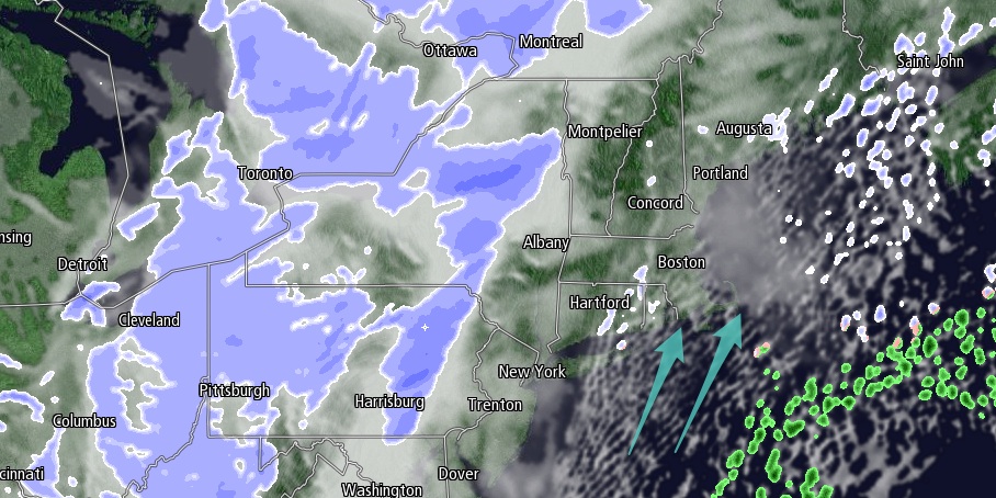
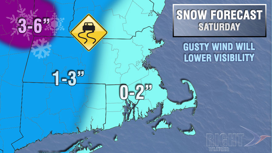
Saturday afternoon looks partly cloudy to mostly cloudy. The howling southwest wind will continue. Highs will be in the mid to upper 30s. More snow showers and squalls are possible by late in the day or early Saturday evening. The showers and squalls could briefly lower visibility making car travel difficult. The best chance of minor accumulations from the snow showers is in Western New England, but a coating to an inch or two cannot be ruled out in RI, SE MA, and E CT. The temperature will nosedive from the 30s to the teens Saturday night. Any wet surfaces will freeze quickly. The wind will stay active and back to west-southwest at 15-30 mph.
Sunday looks dry and very cold. Highs will be in the teens to low 20s, and it will feel colder thanks to a gusty west wind. Another weather system bring the threat of snow showers back to Southern New England Sunday night. A minor accumulation is possible for the Monday morning commute. Once again, the snow showers will be accompanied by gusty south-southwesterly winds.
The mildest weather of next week is likely on Monday. The snow shower threat ends by mid-morning, and highs will be in the upper 30s to low 40s under partly sunny skies. Enjoy the brief warm-up because another shot of Arctic air is in the forecast for the middle of next week. It looks dry through the midweek as a storm developing off the Southeastern United States coast will most likely head out to sea.