The last day of February was the second coldest day of the month in the Providence area. The first day of March will start very cold with lows in the single digits to low teens under clear skies. It will not be as bitter on Saturday afternoon, with highs in the low to mid 30s under partly sunny skies.
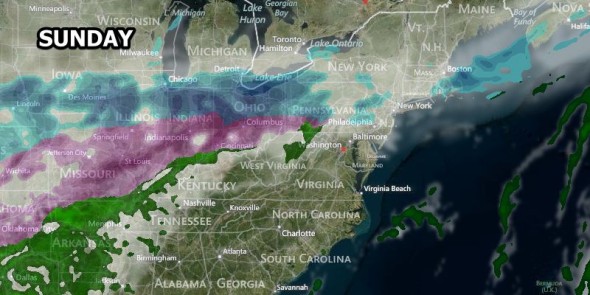
A cold front will ease through on Sunday setting the stage for snow on Monday. There will be rain and snow showers during the day on Sunday. The snow is not expected to accumulate to more than an inch during the day on Sunday. Highs will be in the 30s.
Steadier snow is likely late Sunday night as a sprawling storm reaches New England. Some snow accumulation is possible before and during the Monday morning commute. It will be turning colder with the temperature falling through the 20s.
There is still some uncertainty about the track of the storm, and it will make a big difference in the intensity and amount of precipitation that falls over Southern New England. Right now, we are leaning toward the heaviest snow brushing the coast, with a moderate snowstorm for most of RI and SE MA, and lighter snow farther north. A 50 mile north or south shift in the storm track will mean a 3-4″ difference in snow accumulation for certain areas.
The current forecast is for steady snow, an increasing breeze, and falling temperatures during the day on Monday. The temperature will fall through the teens during the day. The wind will increase to 10-20 mph out of the northeast, except for near the coast where it will be 15-30 mph. Snow should end by late in the day or early in the evening.
The big story after the storm will be unseasonably cold weather through the end of next week. It looks mainly dry Tuesday through Friday, with highs in the 20s and lows in the single digits and teens. Keep in mind, the normal high is in the low to mid 40s, and the normal low is in the mid 20s.
