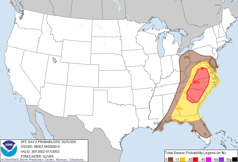
Deadly tornadoes ripped through the Southern United States on Sunday and Monday. As of early Tuesday morning the death toll from the two-day outbreak of dozens of tornadoes was at least 28. The slow-moving weather system responsible for the violent storms is poised to bring another round of severe weather to South, Mid-Atlantic, and Ohio Valley on Tuesday.
Storm Reports April 28, 2014
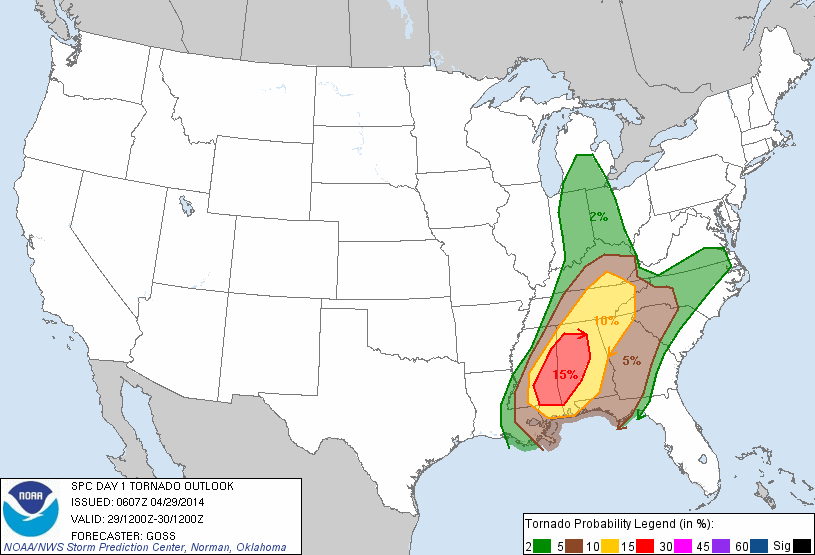
The greatest threat of tornadoes is in eastern Mississippi and western Alabama. Strong storms are possible through the rest of the Southeastern United States.
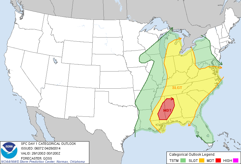
PUBLIC SEVERE WEATHER OUTLOOK
   NWS STORM PREDICTION CENTER NORMAN OK
   0422 AM CDT TUE APR 29 2014

   ...Severe thunderstorms expected over parts of the central Gulf
   Coast and southeast US today and tonight...

   * LOCATIONS...
     Alabama
     Mississippi

   * HAZARDS...
     Several tornadoes
     Scattered damaging winds
     Scattered large hail

   * SUMMARY...
     Scattered to numerous severe thunderstorms will affect portions
     of the lower Mississippi and Tennessee Valleys into central and
     eastern Gulf States this afternoon into tonight. Several
     tornadoes, large hail and straight line damaging winds appear
     likely.

   Preparedness actions...

   Review your severe weather safety procedures for the possibility
   of dangerous weather today. Stay tuned to NOAA Weather Radio,
   weather.gov, or other media for watches and warnings. A tornado
   watch means that conditions are favorable for tornadoes to form
   during the next several hours. If a tornado warning is issued for
   your area, move to a place of safety, ideally in a basement or
   interior room on the lowest floor of a sturdy building.
The storm will continue moving east during the week, and the thunderstorm threat shifts to the Mid-Atlantic on Wednesday. This is the same system that will bring rain to Southern New England on Wednesday and Thursday. There is a chance of thunderstorms on Thursday, but widespread severe weather is not expected.